Cotabato night lights from space
Night Light of Cotabato (Autonomous Region in Muslim Mindanao) from space (Philippines) Src. Average luminocity for 10x10km area is 16.474% and for 50x50km: 2.0231%.
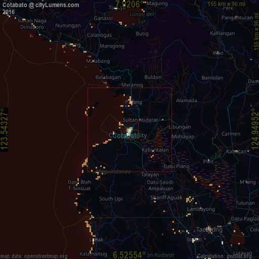
Analysis of Cotabato night lights 2016
Square area 10x10 km:
 2.16%
2.16%90-99
2.16%80-89
1.3%70-79
1.95%60-69
3.9%50-59
3.68%40-49
0%30-39
2.6%20-29
0.87%10-19
2.38%0-9
79%Square area 50x50 km:
0.09%90-99
0.09%80-89
0.28%70-79
0.86%60-69
0.45%50-59
0.2%40-49
0%30-39
0.15%20-29
0.08%10-19
0.15%0-9
97.67%Clear (daylight) street map image can be seen on geolist.org.
Map coordinates:
7° 55' 14.2" North, 123° 32' 35.8" East
7° 13' 25" North, 124° 14' 47" East
6° 31' 31.9" North, 124° 56' 58.3" East
Some cities around Cotabato sort by population:
• Budta
21.4 km =13.3 mi,  95°
95°
• Parang
16.5 km =10.3 mi,  8°
8°
• Pagaluñgan
17.4 km =10.8 mi,  121°
121°
• Pigcawayan
20.6 km =12.8 mi,  73°
73°
• Dalumangcob
6 km =3.7 mi, 97°
• Upi
23.7 km =14.7 mi,  201°
201°
• Awang
8.3 km =5.2 mi, 199°
• Tamontaka
5.3 km =3.3 mi,  205°
205°
1716771 (p: 179,433)
Sources (retrieved 2019-11-25):
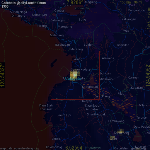
» NASA, Earths city lights 1995
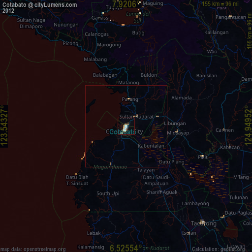
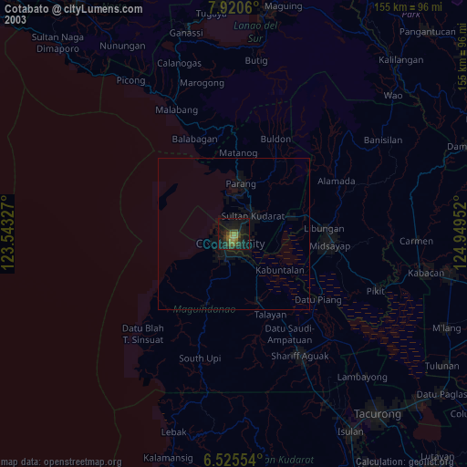
» NASA city lights 2003
» Earth at Night: Flat Maps 2012, 2016