Upi night lights from space
Night Light of Upi (Autonomous Region in Muslim Mindanao) from space (Philippines) Src. Average luminocity for 10x10km area is 0.0498% and for 50x50km: 2.2754%.
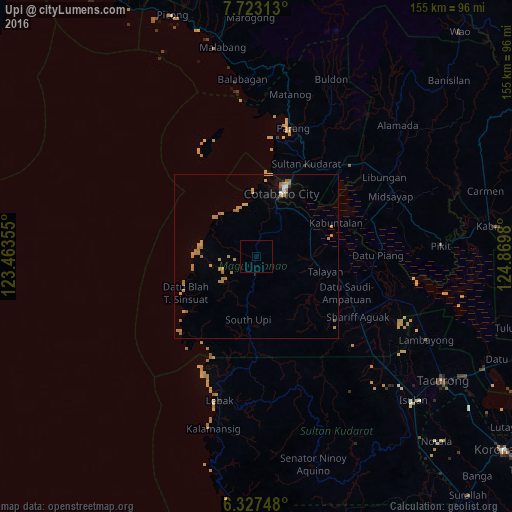
Analysis of Upi night lights 2016
Square area 10x10 km:
 0%
0%90-99
0%80-89
0%70-79
0%60-69
0%50-59
0%40-49
0%30-39
0%20-29
0%10-19
0%0-9
100%Square area 50x50 km:
0.09%90-99
0.09%80-89
0.1%70-79
0.73%60-69
1.21%50-59
0.26%40-49
0%30-39
0.1%20-29
0.03%10-19
0.1%0-9
97.29%Clear (daylight) street map image can be seen on geolist.org.
Map coordinates:
7° 43' 23.3" North, 123° 27' 48.8" East
7° 1' 33" North, 124° 10' 0" East
6° 19' 38.9" North, 124° 52' 11.3" East
Some cities around Upi sort by population:
• Cotabato
23.7 km =14.7 mi,  21°
21°
• Pagaluñgan
26.9 km =16.7 mi,  61°
61°
• Dalican
26.6 km =16.5 mi,  104°
104°
• South Upi
21.5 km =13.4 mi,  184°
184°
• Dalumangcob
25.8 km =16 mi,  34°
34°
• Awang
15.4 km =9.6 mi, 23°
• Dado
32.5 km =20.2 mi,  85°
85°
• Tamontaka
18.4 km =11.4 mi, 20°
1680233 (p: 9,358)
Sources (retrieved 2019-11-25):
» Earth at Night: Flat Maps 2012, 2016