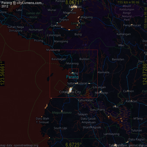
Parang night lights from space
Night Light of Parang (Autonomous Region in Muslim Mindanao) from space (Philippines) Src. Average luminocity for 10x10km area is 8.3636% and for 50x50km: 1.7269%.
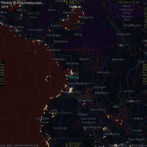
Analysis of Parang night lights 2016
Square area 10x10 km:
 0%
0%90-99
0%80-89
2.6%70-79
5.19%60-69
0.87%50-59
0%40-49
0%30-39
0.43%20-29
0.43%10-19
0.43%0-9
90.04%Square area 50x50 km:
0.08%90-99
0.08%80-89
0.24%70-79
0.67%60-69
0.36%50-59
0.2%40-49
0%30-39
0.18%20-29
0.18%10-19
0.21%0-9
97.8%Clear (daylight) street map image can be seen on geolist.org.
Map coordinates:
8° 4' 1.6" North, 123° 33' 59.8" East
7° 22' 13.3" North, 124° 16' 11" East
6° 40' 21" North, 124° 58' 22.3" East
Some cities around Parang sort by population:
• Cotabato
16.5 km =10.3 mi,  188°
188°
• Pigcawayan
20.1 km =12.5 mi,  121°
121°
• Dalumangcob
17.4 km =10.8 mi,  168°
168°
• Awang
24.7 km =15.3 mi, 192°
• Bugasan
7.9 km =4.9 mi,  351°
351°
• Litayan
26.2 km =16.3 mi,  261°
261°
• Tamontaka
21.7 km =13.5 mi, 192°
• Bayanga
16.9 km =10.5 mi, 353°
1694775 (p: 44,930)
Sources (retrieved 2019-11-25):
» Earth at Night: Flat Maps 2012, 2016