Carpenter Hill night lights from space
Night Light of Carpenter Hill (Soccsksargen) from space (Philippines) Src. Average luminocity for 10x10km area is 2.3831% and for 50x50km: 1.1296%.
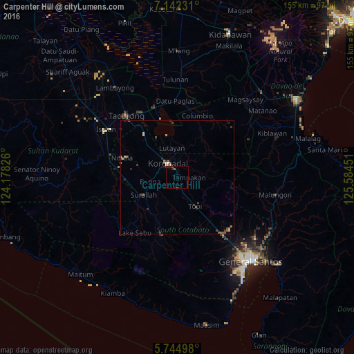
Analysis of Carpenter Hill night lights 2016
Square area 10x10 km:
 0%
0%90-99
0%80-89
0%70-79
0%60-69
0%50-59
0.87%40-49
1.52%30-39
0.65%20-29
2.6%10-19
0%0-9
94.37%Square area 50x50 km:
0.01%90-99
0.15%80-89
0.14%70-79
0.12%60-69
0.18%50-59
0.3%40-49
0.26%30-39
0.34%20-29
0.27%10-19
0.14%0-9
98.1%Clear (daylight) street map image can be seen on geolist.org.
Map coordinates:
7° 8' 32.3" North, 124° 10' 41.7" East
6° 26' 38.9" North, 124° 52' 53" East
5° 44' 41.9" North, 125° 35' 4.2" East
Some cities around Carpenter Hill sort by population:
• Koronadal
7.6 km =4.7 mi,  329°
329°
• Bañga
11.6 km =7.2 mi,  258°
258°
• Surallah
16.9 km =10.5 mi,  243°
243°
• Tupi
14.5 km =9 mi,  147°
147°
• Lamba
12.5 km =7.8 mi,  213°
213°
• Tamnag
14.3 km =8.9 mi,  359°
359°
• Cebuano
11.5 km =7.1 mi,  123°
123°
• Kipalbig
6.2 km =3.9 mi,  126°
126°
1718271 (p: 5,344)
Sources (retrieved 2019-11-25):
» Earth at Night: Flat Maps 2012, 2016