Bañga night lights from space
Night Light of Bañga (Soccsksargen) from space (Philippines) Src. Average luminocity for 10x10km area is 0.0498% and for 50x50km: 1.1504%.

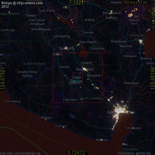

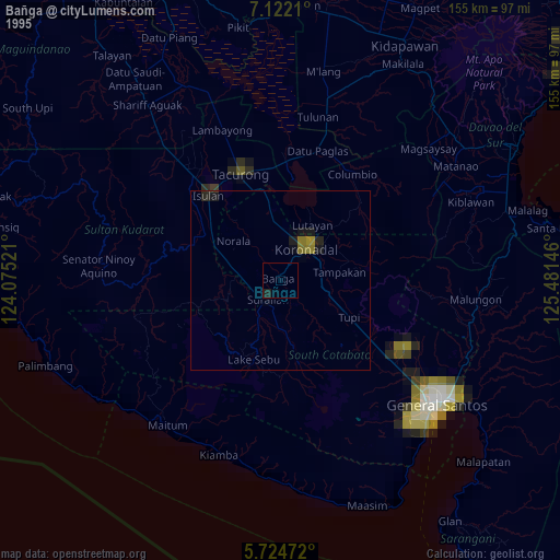
Analysis of Bañga night lights 2016
Square area 10x10 km:
 0%
0%90-99
0%80-89
0%70-79
0%60-69
0%50-59
0%40-49
0%30-39
0%20-29
0%10-19
0%0-9
100%Square area 50x50 km:
0.01%90-99
0.26%80-89
0.18%70-79
0.14%60-69
0.15%50-59
0.17%40-49
0.22%30-39
0.23%20-29
0.3%10-19
0.08%0-9
98.26%Clear (daylight) street map image can be seen on geolist.org.
Map coordinates:
7° 7' 19.6" North, 124° 4' 30.8" East
6° 25' 26" North, 124° 46' 42" East
5° 43' 29" North, 125° 28' 53.3" East
Some cities around Bañga sort by population:
• Koronadal
11.6 km =7.2 mi,  40°
40°
• Surallah
6.5 km =4 mi,  214°
214°
• Santo Niño
9 km =5.6 mi,  277°
277°
• Dahay
7.9 km =4.9 mi,  242°
242°
• Lamba
9.4 km =5.8 mi,  150°
150°
• Lopez Jaena
10.6 km =6.6 mi,  303°
303°
• Carpenter Hill
11.6 km =7.2 mi,  78°
78°
• Kipalbig
16.4 km =10.2 mi,  95°
95°
1727400 (p: 58,855)
Sources (retrieved 2019-11-25):
» NASA, Earths city lights 1995
» NASA city lights 2003
» Earth at Night: Flat Maps 2012, 2016