Canubing No 2 night lights from space
Night Light of Canubing No 2 (Mimaropa) from space (Philippines) Src. Average luminocity for 10x10km area is 1.4752% and for 50x50km: 0.2791%.
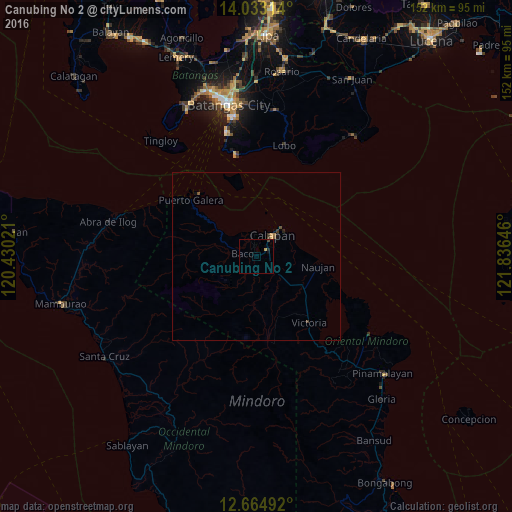
Analysis of Canubing No 2 night lights 2016
Square area 10x10 km:
 0%
0%90-99
0%80-89
0%70-79
0.83%60-69
0%50-59
0%40-49
0.21%30-39
0.62%20-29
0.83%10-19
0.41%0-9
97.11%Square area 50x50 km:
0%90-99
0%80-89
0%70-79
0.1%60-69
0.03%50-59
0.07%40-49
0.03%30-39
0.16%20-29
0.07%10-19
0.14%0-9
99.4%Clear (daylight) street map image can be seen on geolist.org.
Map coordinates:
14° 1' 59.3" North, 120° 25' 48.8" East
13° 21' 0" North, 121° 7' 60" East
12° 39' 53.7" North, 121° 50' 11.3" East
Some cities around Canubing No 2 sort by population:
• Batangas
45.9 km =28.5 mi,  349°
349°
• Calapan
8.5 km =5.3 mi,  36°
36°
• Pinamalayan
49.1 km =30.5 mi,  133°
133°
• Bauan
50.9 km =31.6 mi,  344°
344°
• Victoria
24.8 km =15.4 mi,  140°
140°
• Santa Rita Aplaya
48.1 km =29.9 mi, 347°
• Laiya
46.7 km =29 mi, 38°
• Socorro
42.6 km =26.5 mi, 137°
1718828 (p: 9,569)
Sources (retrieved 2019-11-25):
» Earth at Night: Flat Maps 2012, 2016