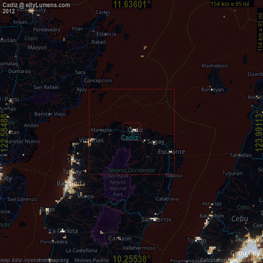
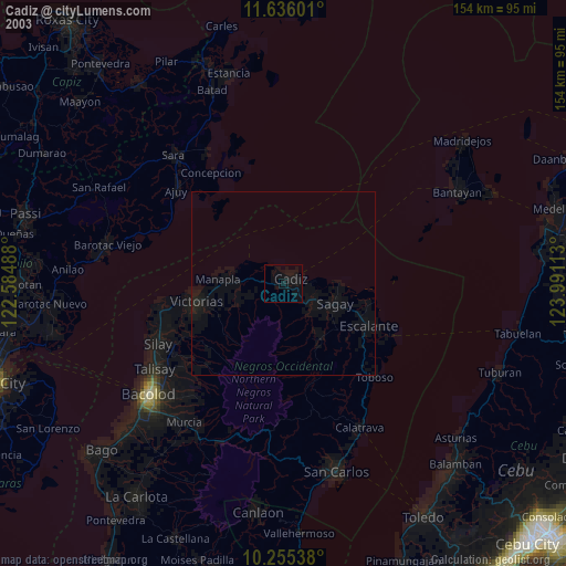
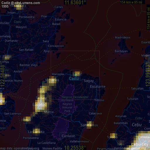
Cadiz night lights from space
Night Light of Cadiz (Western Visayas) from space (Philippines) Src. Average luminocity for 10x10km area is 9.6645% and for 50x50km: 1.1687%.
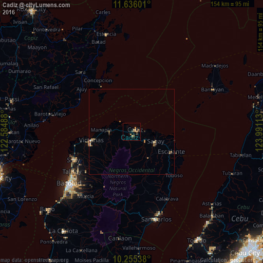
Analysis of Cadiz night lights 2016
Square area 10x10 km:
 0%
0%90-99
0%80-89
1.52%70-79
3.25%60-69
3.03%50-59
1.3%40-49
1.95%30-39
1.95%20-29
1.3%10-19
0.43%0-9
85.28%Square area 50x50 km:
0.02%90-99
0.06%80-89
0.17%70-79
0.2%60-69
0.38%50-59
0.22%40-49
0.2%30-39
0.2%20-29
0.24%10-19
0.09%0-9
98.22%Clear (daylight) street map image can be seen on geolist.org.
Map coordinates:
11° 38' 9.6" North, 122° 35' 5.6" East
10° 56' 47.4" North, 123° 17' 16.8" East
10° 15' 19.4" North, 123° 59' 28.1" East
Some cities around Cadiz sort by population:
• Sagay
14.9 km =9.3 mi,  90°
90°
• Paraiso
10.7 km =6.6 mi,  130°
130°
• Luna
5.6 km =3.5 mi,  296°
296°
• San Pablo
16.4 km =10.2 mi,  256°
256°
• Tiglauigan
7.6 km =4.7 mi,  84°
84°
• Andres Bonifacio
5.3 km =3.3 mi,  231°
231°
• Bato
17.9 km =11.1 mi,  148°
148°
• Lopez Jaena
17.6 km =10.9 mi, 128°
1721168 (p: 129,053)
Sources (retrieved 2019-11-25):
» NASA, Earths city lights 1995
» NASA city lights 2003
» Earth at Night: Flat Maps 2012, 2016