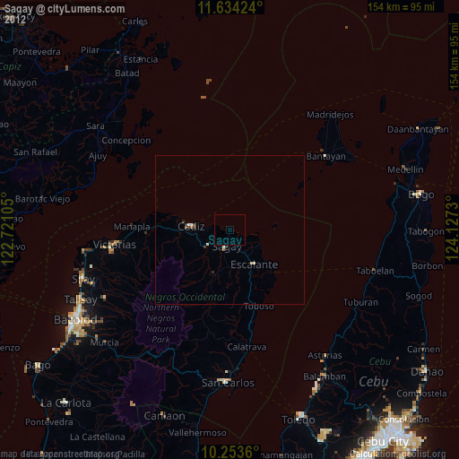
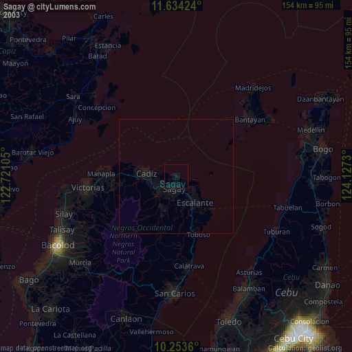
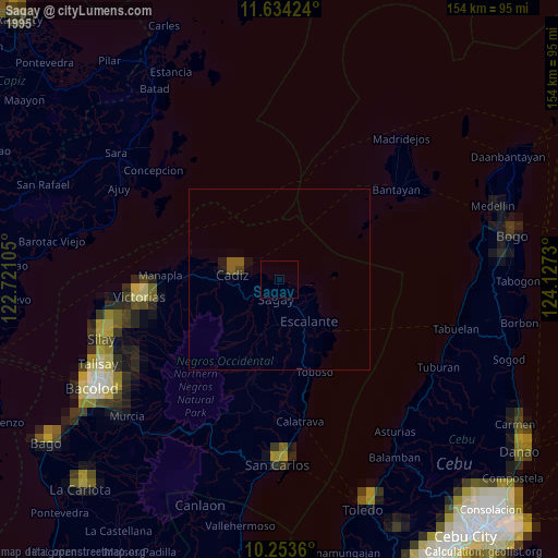
Sagay night lights from space
Night Light of Sagay (Western Visayas) from space (Philippines) Src. Average luminocity for 10x10km area is 0.3896% and for 50x50km: 0.7908%.
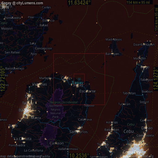
Analysis of Sagay night lights 2016
Square area 10x10 km:
 0%
0%90-99
0%80-89
0%70-79
0%60-69
0%50-59
0%40-49
0.43%30-39
0%20-29
0%10-19
0%0-9
99.57%Square area 50x50 km:
0%90-99
0%80-89
0.09%70-79
0.2%60-69
0.31%50-59
0.09%40-49
0.14%30-39
0.19%20-29
0.15%10-19
0.08%0-9
98.74%Clear (daylight) street map image can be seen on geolist.org.
Map coordinates:
11° 38' 3.3" North, 122° 43' 15.8" East
10° 56' 41" North, 123° 25' 27" East
10° 15' 13" North, 124° 7' 38.3" East
Some cities around Sagay sort by population:
• Cadiz
14.9 km =9.3 mi,  270°
270°
• Escalante
14.2 km =8.8 mi,  144°
144°
• Paraiso
9.4 km =5.8 mi,  225°
225°
• Bolanon
6.2 km =3.9 mi,  119°
119°
• Tiglauigan
7.3 km =4.5 mi,  276°
276°
• Vito
11 km =6.8 mi,  114°
114°
• Lopez Jaena
10.8 km =6.7 mi,  185°
185°
• Plaridel
8.9 km =5.5 mi,  126°
126°
1691150 (p: 72,153)
Sources (retrieved 2019-11-25):
» NASA, Earths city lights 1995
» NASA city lights 2003
» Earth at Night: Flat Maps 2012, 2016