Bulalacao night lights from space
Night Light of Bulalacao (Mimaropa) from space (Philippines) Src. Average luminocity for 10x10km area is 0% and for 50x50km: 0.4182%.
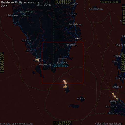
Analysis of Bulalacao night lights 2016
Square area 10x10 km:
 0%
0%90-99
0%80-89
0%70-79
0%60-69
0%50-59
0%40-49
0%30-39
0%20-29
0%10-19
0%0-9
100%Square area 50x50 km:
0.03%90-99
0.01%80-89
0.03%70-79
0.08%60-69
0.13%50-59
0.03%40-49
0.08%30-39
0.14%20-29
0.03%10-19
0.04%0-9
99.39%Clear (daylight) street map image can be seen on geolist.org.
Map coordinates:
13° 0' 40.9" North, 120° 38' 25.4" East
12° 19' 31.3" North, 121° 20' 36.6" East
11° 38' 15.2" North, 122° 2' 47.9" East
Some cities around Bulalacao sort by population:
• San Jose
30.1 km =18.7 mi,  275°
275°
• Mansalay
24 km =14.9 mi,  25°
25°
• Roxas
34.4 km =21.4 mi, 33°
• Calintaan
52 km =32.3 mi,  301°
301°
• Caminauit
28.4 km =17.6 mi,  271°
271°
• Magsaysay
21 km =13 mi, 272°
• Semirara
29.1 km =18.1 mi,  168°
168°
• Bagong Sikat
31 km =19.3 mi, 278°
1723002 (p: 12,027)
Sources (retrieved 2019-11-25):
» Earth at Night: Flat Maps 2012, 2016