Bugallon night lights from space
Night Light of Bugallon (Ilocos) from space (Philippines) Src. Average luminocity for 10x10km area is 1.0682% and for 50x50km: 3.6684%.
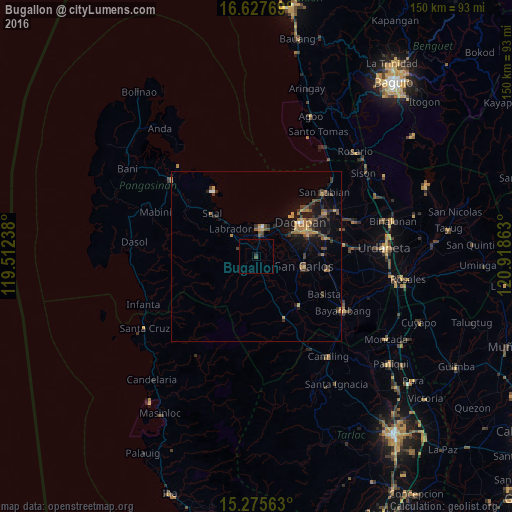
Analysis of Bugallon night lights 2016
Square area 10x10 km:
 0%
0%90-99
0%80-89
0%70-79
0%60-69
0%50-59
0%40-49
0.83%30-39
0%20-29
0.83%10-19
0.41%0-9
97.93%Square area 50x50 km:
0.1%90-99
0.07%80-89
0.24%70-79
0.8%60-69
0.83%50-59
0.44%40-49
0.85%30-39
1.07%20-29
0.84%10-19
3.03%0-9
91.72%Clear (daylight) street map image can be seen on geolist.org.
Map coordinates:
16° 37' 39.7" North, 119° 30' 44.6" East
15° 57' 10.1" North, 120° 12' 55.8" East
15° 16' 32.3" North, 120° 55' 7.1" East
Some cities around Bugallon sort by population:
• Dagupan
16.1 km =10 mi,  51°
51°
• Lingayen
7.9 km =4.9 mi,  12°
12°
• Binmaley
10.5 km =6.5 mi,  32°
32°
• Domalanoan
5.6 km =3.5 mi,  355°
355°
• Aguilar
7.5 km =4.7 mi,  161°
161°
• Nagsaing
13.4 km =8.3 mi,  76°
76°
• Magtaking
5 km =3.1 mi,  316°
316°
• Tamayo
11.2 km =7 mi,  138°
138°
1723337 (p: 12,033)
Sources (retrieved 2019-11-25):
» Earth at Night: Flat Maps 2012, 2016