Aguilar night lights from space
Night Light of Aguilar (Ilocos) from space (Philippines) Src. Average luminocity for 10x10km area is 0% and for 50x50km: 3.6311%.
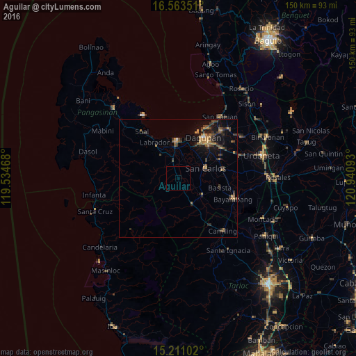
Analysis of Aguilar night lights 2016
Square area 10x10 km:
 0%
0%90-99
0%80-89
0%70-79
0%60-69
0%50-59
0%40-49
0%30-39
0%20-29
0%10-19
0%0-9
100%Square area 50x50 km:
0.06%90-99
0.04%80-89
0.25%70-79
0.79%60-69
0.87%50-59
0.49%40-49
0.93%30-39
0.97%20-29
0.85%10-19
3.01%0-9
91.75%Clear (daylight) street map image can be seen on geolist.org.
Map coordinates:
16° 33' 48.6" North, 119° 32' 4.8" East
15° 53' 18.2" North, 120° 14' 16.1" East
15° 12' 39.7" North, 120° 56' 27.3" East
Some cities around Aguilar sort by population:
• Domalanoan
13 km =8.1 mi,  347°
347°
• Urbiztondo
12.2 km =7.6 mi,  126°
126°
• Mangatarem
12.6 km =7.8 mi,  152°
152°
• Bugallon
7.5 km =4.7 mi,  341°
341°
• Nagsaing
14.8 km =9.2 mi,  46°
46°
• Magtaking
12.3 km =7.6 mi,  331°
331°
• Tamayo
5.1 km =3.2 mi,  103°
103°
• Dorongan Punta
12.2 km =7.6 mi, 132°
1731859 (p: 9,801)
Sources (retrieved 2019-11-25):
» Earth at Night: Flat Maps 2012, 2016