Barili night lights from space
Night Light of Barili (Central Visayas) from space (Philippines) Src. Average luminocity for 10x10km area is 0.5207% and for 50x50km: 1.538%.
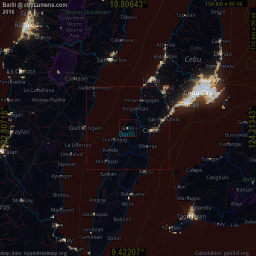
Analysis of Barili night lights 2016
Square area 10x10 km:
 0%
0%90-99
0%80-89
0%70-79
0%60-69
0.83%50-59
0%40-49
0%30-39
0%20-29
0%10-19
0%0-9
99.17%Square area 50x50 km:
0.07%90-99
0.07%80-89
0.19%70-79
0.09%60-69
0.29%50-59
0.14%40-49
0.44%30-39
0.51%20-29
0.58%10-19
0.39%0-9
97.25%Clear (daylight) street map image can be seen on geolist.org.
Map coordinates:
10° 48' 23.1" North, 122° 48' 25.8" East
10° 6' 54" North, 123° 30' 37.1" East
9° 25' 19.5" North, 124° 12' 48.3" East
Some cities around Barili sort by population:
• Carcar
14.3 km =8.9 mi,  93°
93°
• Ocaña
13.6 km =8.5 mi,  113°
113°
• Sibonga
16 km =9.9 mi,  133°
133°
• Guadalupe
10.6 km =6.6 mi, 89°
• Can-asujan
16.2 km =10.1 mi,  84°
84°
• Bonbon
13.2 km =8.2 mi,  22°
22°
• Tapon
9.2 km =5.7 mi,  230°
230°
• Valencia
11.4 km =7.1 mi, 78°
1726670 (p: 7,588)
Sources (retrieved 2019-11-25):
» Earth at Night: Flat Maps 2012, 2016