Alabel night lights from space
Night Light of Alabel (Soccsksargen) from space (Philippines) Src. Average luminocity for 10x10km area is 5.7665% and for 50x50km: 6.108%.
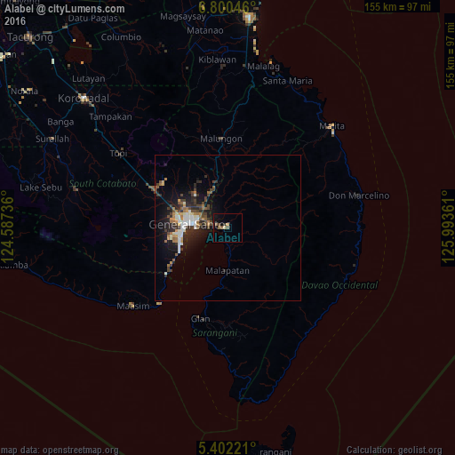
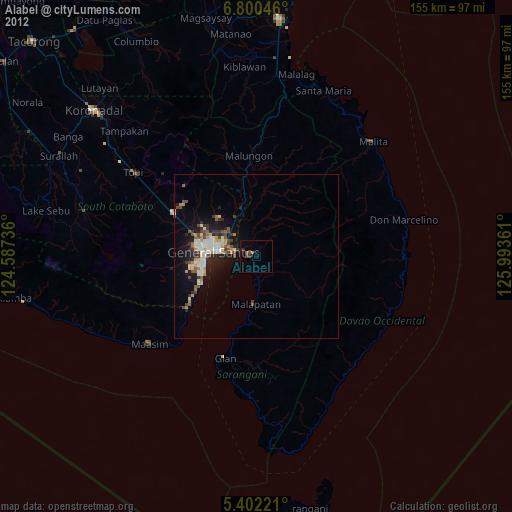
Analysis of Alabel night lights 2016
Square area 10x10 km:
 0%
0%90-99
0%80-89
0.83%70-79
0.41%60-69
1.24%50-59
2.27%40-49
1.03%30-39
0%20-29
0.83%10-19
4.75%0-9
88.64%Square area 50x50 km:
0.75%90-99
1.04%80-89
0.36%70-79
0.58%60-69
1.03%50-59
0.77%40-49
1.11%30-39
1.23%20-29
2.01%10-19
4.24%0-9
86.89%Clear (daylight) street map image can be seen on geolist.org.
Map coordinates:
6° 48' 1.7" North, 124° 35' 14.5" East
6° 6' 6.4" North, 125° 17' 25.7" East
5° 24' 8" North, 125° 59' 37" East
Some cities around Alabel sort by population:
• General Santos
13.2 km =8.2 mi,  275°
275°
• Maluñgun
19.7 km =12.2 mi,  357°
357°
• Malapatan
14.7 km =9.1 mi,  180°
180°
• Buayan
6.4 km =4 mi, 284°
• Lun Pequeño
7.2 km =4.5 mi,  185°
185°
• Conel
16 km =9.9 mi,  314°
314°
• Katangawan
10.9 km =6.8 mi,  315°
315°
• Suyan
11.5 km =7.1 mi,  113°
113°
1731744 (p: 43,312)
Sources (retrieved 2019-11-25):
» Earth at Night: Flat Maps 2012, 2016