Malapatan night lights from space
Night Light of Malapatan (Soccsksargen) from space (Philippines) Src. Average luminocity for 10x10km area is 0.2149% and for 50x50km: 5.439%.
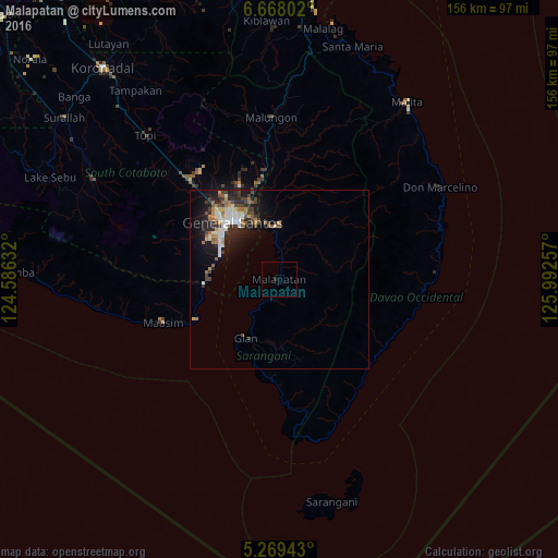
Analysis of Malapatan night lights 2016
Square area 10x10 km:
 0%
0%90-99
0%80-89
0%70-79
0%60-69
0%50-59
0%40-49
0%30-39
0%20-29
0.83%10-19
0%0-9
99.17%Square area 50x50 km:
0.73%90-99
1.03%80-89
0.35%70-79
0.54%60-69
0.96%50-59
0.58%40-49
0.96%30-39
0.9%20-29
1.78%10-19
3.83%0-9
88.33%Clear (daylight) street map image can be seen on geolist.org.
Map coordinates:
6° 40' 4.9" North, 124° 35' 10.8" East
5° 58' 9" North, 125° 17' 22" East
5° 16' 9.9" North, 125° 59' 33.3" East
Some cities around Malapatan sort by population:
• General Santos
20.6 km =12.8 mi,  320°
320°
• Alabel
14.7 km =9.1 mi,  0°
0°
• Glan
18.7 km =11.6 mi,  210°
210°
• Buayan
17.5 km =10.9 mi,  339°
339°
• Lun Pequeño
7.7 km =4.8 mi,  355°
355°
• Sapu Padidu
6.3 km =3.9 mi,  203°
203°
• Katangawan
23.8 km =14.8 mi, 341°
• Suyan
14.7 km =9.1 mi,  46°
46°
1703051 (p: 19,439)
Sources (retrieved 2019-11-25):
» Earth at Night: Flat Maps 2012, 2016