La Unión night lights from space
Night Light of La Unión (Piura) from space (Peru) Src. Average luminocity for 10x10km area is 21.6632% and for 50x50km: 7.9745%.
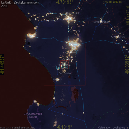
Analysis of La Unión night lights 2016
Square area 10x10 km:
100  0%
0%
90-99 0%
80-89 3.31%
70-79 4.96%
60-69 4.13%
50-59 2.48%
40-49 4.96%
30-39 5.79%
20-29 4.34%
10-19 23.55%
0-9 46.49%
0%90-99
0%80-89
3.31%70-79
4.96%60-69
4.13%50-59
2.48%40-49
4.96%30-39
5.79%20-29
4.34%10-19
23.55%0-9
46.49%Square area 50x50 km:
100 0.89%
90-99 0.97%
80-89 1.4%
70-79 0.93%
60-69 1.05%
50-59 0.87%
40-49 1%
30-39 1.55%
20-29 2.32%
10-19 5.82%
0-9 83.18%
0.89%90-99
0.97%80-89
1.4%70-79
0.93%60-69
1.05%50-59
0.87%40-49
1%30-39
1.55%20-29
2.32%10-19
5.82%0-9
83.18%Clear (daylight) street map image can be seen on geolist.org.
Map coordinates:
4° 42' 6.9" South, 81° 26' 43.3" West
5° 24' 8.4" South, 80° 44' 32.1" West
6° 6' 6.8" South, 80° 2' 20.8" West
Some cities around La Unión sort by population:
• Piura
26.1 km =16.2 mi,  27°
27°
• Sullana
55.8 km =34.7 mi,  6°
6°
• Catacaos
16.4 km =10.2 mi,  23°
23°
• Paita
54 km =33.6 mi,  310°
310°
• Sechura
19.3 km =12 mi,  207°
207°
• Salinera Colán
54.5 km =33.9 mi,  318°
318°
• Vice
4.8 km =3 mi,  250°
250°
• Bernal
5.4 km =3.4 mi,  189°
189°
3695466 (p: 34,834)
Sources (retrieved 2019-11-25):
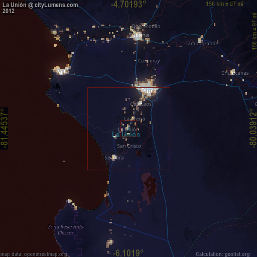
» Earth at Night: Flat Maps 2012, 2016