Chincha Alta night lights from space
Night Light of Chincha Alta (Ica) from space (Peru) Src. Average luminocity for 10x10km area is 57.5475% and for 50x50km: 4.5002%.
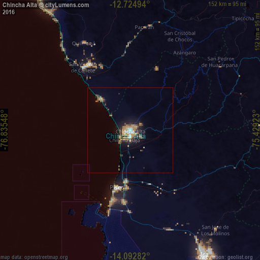
Analysis of Chincha Alta night lights 2016
Square area 10x10 km:
 8.68%
8.68%90-99
7.23%80-89
9.71%70-79
13.43%60-69
17.36%50-59
3.93%40-49
5.37%30-39
6.82%20-29
12.19%10-19
15.08%0-9
0.21%Square area 50x50 km:
0.36%90-99
0.35%80-89
0.51%70-79
0.76%60-69
1.26%50-59
0.5%40-49
0.52%30-39
0.68%20-29
1.22%10-19
3.46%0-9
90.39%Clear (daylight) street map image can be seen on geolist.org.
Map coordinates:
12° 43' 29.8" South, 76° 50' 7.7" West
13° 24' 35.5" South, 76° 7' 56.5" West
14° 5' 34.2" South, 75° 25' 45.2" West
Some cities around Chincha Alta sort by population:
• Pisco
34.3 km =21.3 mi,  193°
193°
• Imperial
45.7 km =28.4 mi,  328°
328°
• Nuevo Imperial
42.2 km =26.2 mi, 331°
• San Vicente de Cañete
46.2 km =28.7 mi,  323°
323°
• San Clemente
28.6 km =17.8 mi,  183°
183°
• Villa Tupac Amaru
33.6 km =20.9 mi, 183°
• Subtanjalla
78.9 km =49 mi,  149°
149°
• Quilmaná
57.9 km =36 mi, 332°
3943789 (p: 153,076)
Sources (retrieved 2019-11-25):
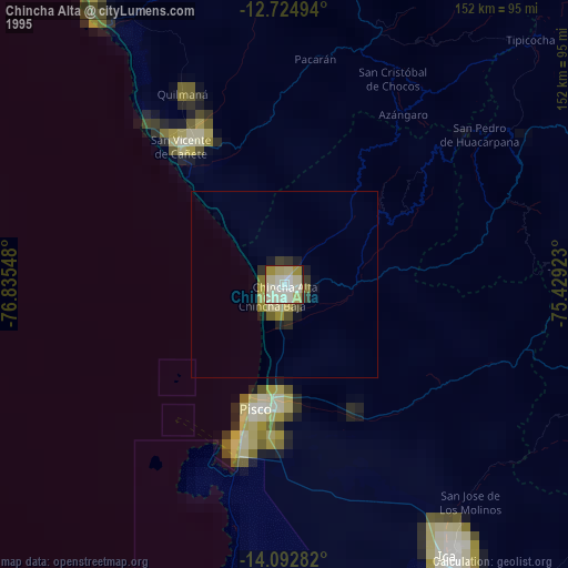
» NASA, Earths city lights 1995
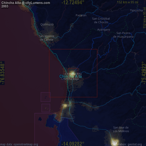
» NASA city lights 2003
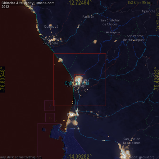
» Earth at Night: Flat Maps 2012, 2016