Chilibre night lights from space
Night Light of Chilibre (Panamá) from space (Panama) Src. Average luminocity for 10x10km area is 29.961% and for 50x50km: 21.7969%.
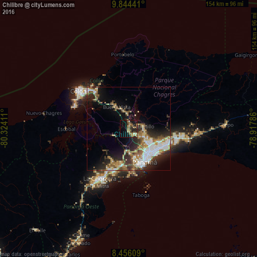
Analysis of Chilibre night lights 2016
Square area 10x10 km:
 0%
0%90-99
3.68%80-89
3.9%70-79
6.28%60-69
6.06%50-59
7.79%40-49
4.11%30-39
3.03%20-29
11.9%10-19
25.32%0-9
27.92%Square area 50x50 km:
4.12%90-99
4.14%80-89
2.47%70-79
2.34%60-69
2.96%50-59
3.45%40-49
2.3%30-39
3.63%20-29
6.44%10-19
9.57%0-9
58.59%Clear (daylight) street map image can be seen on geolist.org.
Map coordinates:
9° 50' 39.9" North, 80° 19' 26.8" West
9° 9' 3.3" North, 79° 37' 15.5" West
8° 27' 21.9" North, 78° 55' 4.3" West
Some cities around Chilibre sort by population:
• San Miguelito
19.9 km =12.4 mi,  124°
124°
• Las Cumbres
12.3 km =7.6 mi, 123°
• Río Abajo
20 km =12.4 mi,  138°
138°
• Alcalde Díaz
7.9 km =4.9 mi, 115°
• La Cabima
9.9 km =6.2 mi,  111°
111°
• Villa Unida
4.3 km =2.7 mi,  354°
354°
• San Vicente
4.8 km =3 mi,  147°
147°
• Gonzalillo
13 km =8.1 mi, 120°
3712455 (p: 33,536)
Sources (retrieved 2019-11-25):
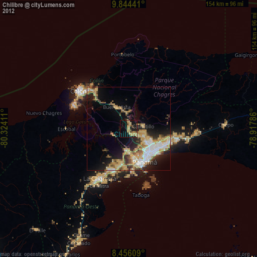
» Earth at Night: Flat Maps 2012, 2016