Alcalde Díaz night lights from space
Night Light of Alcalde Díaz (Panamá) from space (Panama) Src. Average luminocity for 10x10km area is 53.5065% and for 50x50km: 24.4707%.
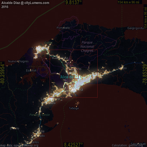
Analysis of Alcalde Díaz night lights 2016
Square area 10x10 km:
 3.68%
3.68%90-99
10.82%80-89
11.47%70-79
5.41%60-69
12.99%50-59
9.74%40-49
3.46%30-39
9.52%20-29
25.76%10-19
7.14%0-9
0%Square area 50x50 km:
4.65%90-99
4.52%80-89
2.97%70-79
2.7%60-69
3.16%50-59
3.93%40-49
2.63%30-39
4.25%20-29
7.49%10-19
10.29%0-9
53.41%Clear (daylight) street map image can be seen on geolist.org.
Map coordinates:
9° 48' 49.3" North, 80° 15' 34.3" West
9° 7' 12.6" North, 79° 33' 23.1" West
8° 25' 31" North, 78° 51' 11.8" West
Some cities around Alcalde Díaz sort by population:
• San Miguelito
12.2 km =7.6 mi,  129°
129°
• Las Cumbres
4.6 km =2.9 mi,  137°
137°
• Chilibre
7.9 km =4.9 mi,  295°
295°
• Río Abajo
13.1 km =8.1 mi,  151°
151°
• La Cabima
2.2 km =1.4 mi,  94°
94°
• Villa Unida
10.7 km =6.6 mi,  315°
315°
• San Vicente
4.6 km =2.9 mi,  261°
261°
• Gonzalillo
5.2 km =3.2 mi, 127°
3714932 (p: 20,285)
Sources (retrieved 2019-11-25):
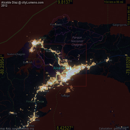
» Earth at Night: Flat Maps 2012, 2016