Sur night lights from space
Night Light of Sur (Southeastern Governorate) from space (Oman) Src. Average luminocity for 10x10km area is 57.375% and for 50x50km: 10.7013%.
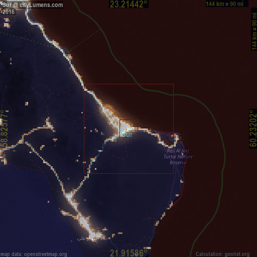
Analysis of Sur night lights 2016
Square area 10x10 km:
 16.67%
90-99
15.53%80-89
3.6%70-79
2.65%60-69
6.63%50-59
8.9%40-49
7.77%30-39
7.01%20-29
11.55%10-19
18.75%0-9
0.95%Square area 50x50 km:
1.36%90-99
1.84%80-89
0.93%70-79
0.88%60-69
1.26%50-59
2.58%40-49
1.33%30-39
1.83%20-29
2.65%10-19
7.23%0-9
78.12%Clear (daylight) street map image can be seen on geolist.org.
Map coordinates:
23° 12' 51.9" North, 58° 49' 32.8" East
22° 34' 0" North, 59° 31' 44" East
21° 54' 57.1" North, 60° 13' 55.3" East
Some cities around Sur sort by population:
• Muscat
161.1 km =100.1 mi,  314°
314°
• Seeb
183.9 km =114.3 mi, 311°
• Bawshar
161.2 km =100.2 mi, 314°
• Sufālat Samā’il
175.9 km =109.3 mi,  298°
298°
• Ibrā’
103.1 km =64.1 mi,  277°
277°
• Bidbid
171.2 km =106.4 mi, 303°
• Badīyah
76 km =47.2 mi,  260°
260°
• Al Qābil
85.6 km =53.2 mi,  270°
270°
286245 (p: 71,152)
Sources (retrieved 2019-11-25):
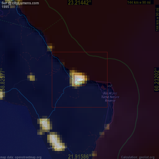
» NASA, Earths city lights 1995
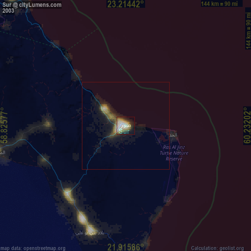
» NASA city lights 2003
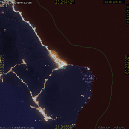
» Earth at Night: Flat Maps 2012, 2016