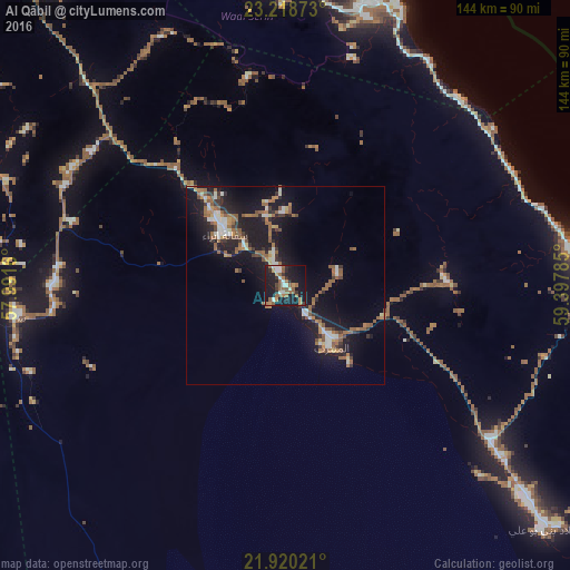
Al Qābil night lights from space
Night Light of Al Qābil (Northeastern Governorate) from space (Oman) Src. Average luminocity for 10x10km area is 35.1023% and for 50x50km: 11.6836%.
Analysis of Al Qābil night lights 2016
Square area 10x10 km:
 4.17%
4.17%90-99
5.11%80-89
0.76%70-79
4.36%60-69
6.63%50-59
12.88%40-49
0.95%30-39
3.6%20-29
7.58%10-19
46.78%0-9
7.2%Square area 50x50 km:
1.29%90-99
1.36%80-89
0.59%70-79
0.97%60-69
2.39%50-59
3.3%40-49
0.66%30-39
1.62%20-29
2.94%10-19
13.76%0-9
71.13%Clear (daylight) street map image can be seen on geolist.org.
Map coordinates:
23° 13' 7.4" North, 57° 59' 29.8" East
22° 34' 15.6" North, 58° 41' 41" East
21° 55' 12.8" North, 59° 23' 52.3" East
Some cities around Al Qābil sort by population:
• Muscat
116.4 km =72.3 mi,  345°
345°
• Bawshar
115.9 km =72 mi,  344°
344°
• Sur
85.6 km =53.2 mi,  90°
90°
• Sufālat Samā’il
108.1 km =67.2 mi,  320°
320°
• Izkī
103.3 km =64.2 mi,  292°
292°
• Ibrā’
21.2 km =13.2 mi,  308°
308°
• Bidbid
109.6 km =68.1 mi,  328°
328°
• Badīyah
17.3 km =10.7 mi,  141°
141°
289142 (p: 14,008)
Sources (retrieved 2019-11-25):
» Earth at Night: Flat Maps 2012, 2016