Wellington night lights from space
Night Light of Wellington from space (New Zealand) Src. Average luminocity for 10x10km area is 48.7338% and for 50x50km: 8.2924%.
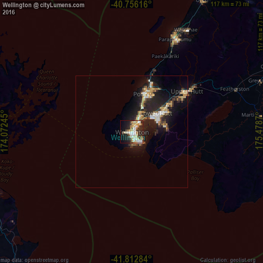
Analysis of Wellington night lights 2016
Square area 10x10 km:
 9.09%
9.09%90-99
12.82%80-89
7.63%70-79
8.6%60-69
3.41%50-59
2.44%40-49
3.57%30-39
6.17%20-29
17.05%10-19
16.4%0-9
12.82%Square area 50x50 km:
0.83%90-99
1.41%80-89
1.11%70-79
1.34%60-69
0.77%50-59
0.74%40-49
0.79%30-39
1.37%20-29
3.75%10-19
7.42%0-9
80.47%Clear (daylight) street map image can be seen on geolist.org.
Map coordinates:
40° 45' 22.2" South, 174° 4' 20.8" East
41° 17' 11.9" South, 174° 46' 32.1" East
41° 48' 46.2" South, 175° 28' 43.3" East
Some cities around Wellington sort by population:
• Lower Hutt
14.1 km =8.8 mi,  56°
56°
• Porirua
18.1 km =11.2 mi,  20°
20°
• Upper Hutt
28.3 km =17.6 mi,  54°
54°
• Blenheim
73.2 km =45.5 mi,  249°
249°
• Paraparaumu
45.8 km =28.5 mi,  26°
26°
• Khandallah
4.9 km =3 mi, 18°
• Petone
10.2 km =6.3 mi, 50°
• Otaki
66.6 km =41.4 mi, 28°
2179537 (p: 381,900)
Sources (retrieved 2019-11-25):
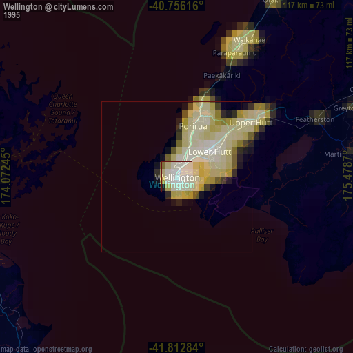
» NASA, Earths city lights 1995
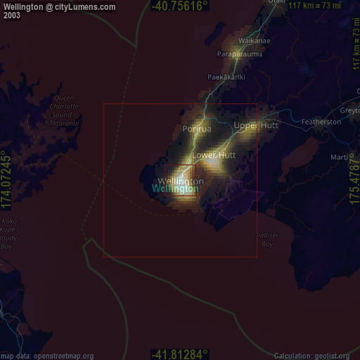
» NASA city lights 2003
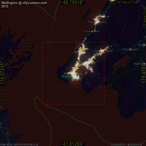
» Earth at Night: Flat Maps 2012, 2016