Alofi night lights from space
Night Light of Alofi from space (Niue) Src. Average luminocity for 10x10km area is 13.7532% and for 50x50km: 2.1452%.
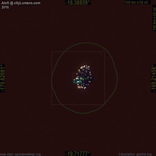
Analysis of Alofi night lights 2016
Square area 10x10 km:
 1.73%
1.73%90-99
3.03%80-89
1.3%70-79
0.87%60-69
0%50-59
1.3%40-49
5.63%30-39
0%20-29
0%10-19
0.22%0-9
85.93%Square area 50x50 km:
0.25%90-99
0.43%80-89
0.19%70-79
0.12%60-69
0.1%50-59
0.39%40-49
0.67%30-39
0.06%20-29
0%10-19
0.1%0-9
97.7%Clear (daylight) street map image can be seen on geolist.org.
Map coordinates:
18° 23' 18.9" South, 170° 37' 14.9" West
19° 3' 16.2" South, 169° 55' 3.6" West
19° 43' 4" South, 169° 12' 52.4" West
Some cities around Alofi sort by population:
• Pago Pago, AS
537.6 km =334 mi,  351°
351°
• Tāfuna, AS
531.6 km =330.3 mi, 350°
• Lapaha, TO
591.9 km =367.8 mi,  246°
246°
• Neiafu, TO
430.2 km =267.3 mi,  275°
275°
• Pangai, TO
472.8 km =293.8 mi,  259°
259°
• ‘Ohonua, TO
583 km =362.3 mi,  244°
244°
• Ta`ū, AS
537.8 km =334.2 mi,  4°
4°
• Hihifo, TO
536.6 km =333.4 mi,  309°
309°
4036284 (p: 624)
Sources (retrieved 2019-11-25):
» Earth at Night: Flat Maps 2012, 2016