Besisahar night lights from space
Night Light of Besisahar (Karnali Pradesh) from space (Nepal) Src. Average luminocity for 10x10km area is 0% and for 50x50km: 0.3528%.
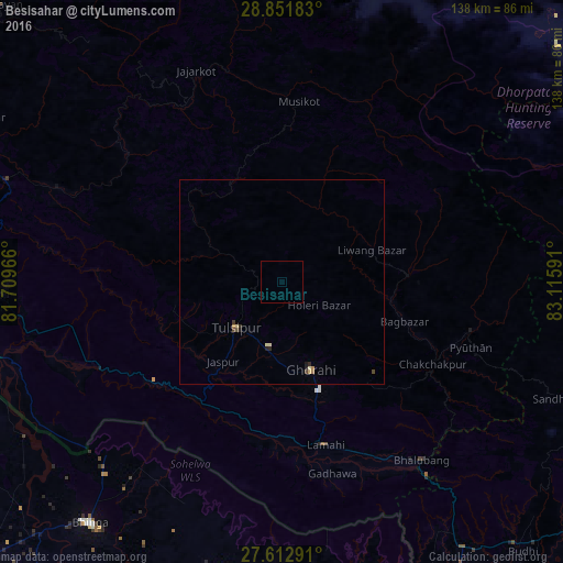
Analysis of Besisahar night lights 2016
Square area 10x10 km:
 0%
0%90-99
0%80-89
0%70-79
0%60-69
0%50-59
0%40-49
0%30-39
0%20-29
0%10-19
0%0-9
100%Square area 50x50 km:
0%90-99
0.04%80-89
0.11%70-79
0.03%60-69
0.06%50-59
0.01%40-49
0.11%30-39
0.06%20-29
0.1%10-19
0.08%0-9
99.39%Clear (daylight) street map image can be seen on geolist.org.
Map coordinates:
28° 51' 6.6" North, 81° 42' 34.8" East
28° 14' 3" North, 82° 24' 46" East
27° 36' 46.5" North, 83° 6' 57.3" East
Some cities around Besisahar sort by population:
• Nepalgunj
80.7 km =50.1 mi,  255°
255°
• Tulsīpur
16.1 km =10 mi,  224°
224°
• Birendranagar
86.5 km =53.7 mi,  298°
298°
• Tulsīpur, IN
77.9 km =48.4 mi,  179°
179°
• Bhinga, IN
75.5 km =46.9 mi, 218°
• Pachperwa, IN
83.4 km =51.8 mi,  164°
164°
• Ikauna, IN
89.5 km =55.6 mi,  209°
209°
• Katra, IN
89.2 km =55.4 mi, 205°
6254842 (p: 5,427)
Sources (retrieved 2019-11-25):
» Earth at Night: Flat Maps 2012, 2016