Jessheim night lights from space
Night Light of Jessheim (Akershus) from space (Norway) Src. Average luminocity for 10x10km area is 36.8926% and for 50x50km: 13.1953%.
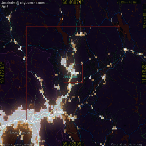
Analysis of Jessheim night lights 2016
Square area 10x10 km:
 8.47%
8.47%90-99
9.19%80-89
4.13%70-79
2.89%60-69
2.17%50-59
1.86%40-49
1.45%30-39
1.65%20-29
23.04%10-19
24.38%0-9
20.76%Square area 50x50 km:
3.63%90-99
3.17%80-89
1.03%70-79
0.87%60-69
0.96%50-59
0.95%40-49
1.13%30-39
1.6%20-29
3.5%10-19
7.41%0-9
75.76%Clear (daylight) street map image can be seen on geolist.org.
Map coordinates:
60° 29' 23" North, 10° 28' 19.3" East
60° 8' 29.4" North, 11° 10' 30.5" East
59° 47' 22.5" North, 11° 52' 41.8" East
Some cities around Jessheim sort by population:
• Oslo
34.9 km =21.7 mi,  223°
223°
• Lillestrøm
21.8 km =13.5 mi,  198°
198°
• Ski
50.6 km =31.4 mi, 201°
• Kongsvinger
45.8 km =28.5 mi,  83°
83°
• Nesoddtangen
42.1 km =26.2 mi, 222°
• Råholt
14.9 km =9.3 mi,  0°
0°
• Fetsund
24.1 km =15 mi,  182°
182°
• Kløfta
7.8 km =4.8 mi, 195°
3150851 (p: 12,365)
Sources (retrieved 2019-11-25):
» Earth at Night: Flat Maps 2012, 2016