Kongsvinger night lights from space
Night Light of Kongsvinger (Hedmark) from space (Norway) Src. Average luminocity for 10x10km area is 19.2025% and for 50x50km: 1.3477%.
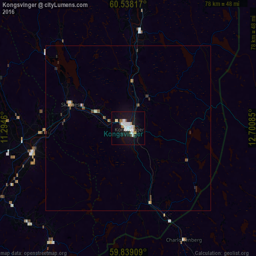
Analysis of Kongsvinger night lights 2016
Square area 10x10 km:
 5.58%
5.58%90-99
4.55%80-89
0.62%70-79
1.34%60-69
0.93%50-59
1.76%40-49
1.34%30-39
0%20-29
0.21%10-19
24.79%0-9
58.88%Square area 50x50 km:
0.25%90-99
0.25%80-89
0.04%70-79
0.13%60-69
0.08%50-59
0.25%40-49
0.23%30-39
0.13%20-29
0.16%10-19
1.02%0-9
97.46%Clear (daylight) street map image can be seen on geolist.org.
Map coordinates:
60° 32' 17.4" North, 11° 17' 40.6" East
60° 11' 25.8" North, 11° 59' 51.8" East
59° 50' 20.7" North, 12° 42' 3.1" East
Some cities around Kongsvinger sort by population:
• Oslo
76 km =47.2 mi,  246°
246°
• Lillestrøm
58.7 km =36.5 mi,  243°
243°
• Arvika, SE
67.9 km =42.2 mi,  151°
151°
• Jessheim
45.8 km =28.5 mi,  263°
263°
• Råholt
46.2 km =28.7 mi,  281°
281°
• Fetsund
55.2 km =34.3 mi, 237°
• Kløfta
49.3 km =30.6 mi, 254°
• Sunne, SE
74.8 km =46.5 mi,  121°
121°
3149533 (p: 11,181)
Sources (retrieved 2019-11-25):
» Earth at Night: Flat Maps 2012, 2016