Oslo night lights from space
Night Light of Oslo from space (Norway) Src. Average luminocity for 10x10km area is 88.2587% and for 50x50km: 26.608%.
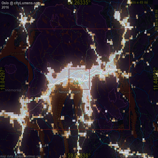
Analysis of Oslo night lights 2016
Square area 10x10 km:
 52.71%
90-99
22.62%80-89
3.79%70-79
1.95%60-69
4.44%50-59
3.68%40-49
2.6%30-39
6.49%20-29
1.73%10-19
0%0-9
0%Square area 50x50 km:
8.05%90-99
6.52%80-89
1.81%70-79
1.52%60-69
1.77%50-59
1.7%40-49
2.03%30-39
4.31%20-29
8.33%10-19
14.63%0-9
49.33%Clear (daylight) street map image can be seen on geolist.org.
Map coordinates:
60° 15' 48.1" North, 10° 2' 34.7" East
59° 54' 45.8" North, 10° 44' 45.9" East
59° 33' 30.1" North, 11° 26' 57.2" East
Some cities around Oslo sort by population:
• Asker
19.4 km =12.1 mi,  242°
242°
• Lillestrøm
17.6 km =10.9 mi,  74°
74°
• Ski
22.1 km =13.7 mi,  166°
166°
• Drøbak
28.5 km =17.7 mi,  193°
193°
• Nesoddtangen
7.3 km =4.5 mi,  219°
219°
• Ås
27.7 km =17.2 mi, 174°
• Fetsund
22.9 km =14.2 mi,  86°
86°
• Kløfta
28.2 km =17.5 mi,  50°
50°
3143244 (p: 580,000)
Sources (retrieved 2019-11-25):
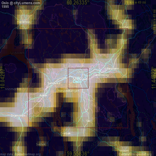
» NASA, Earths city lights 1995
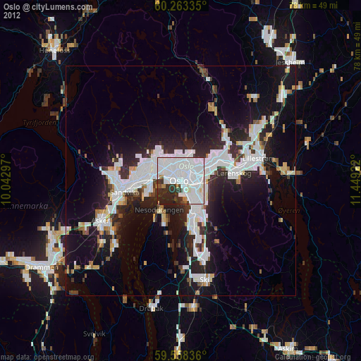
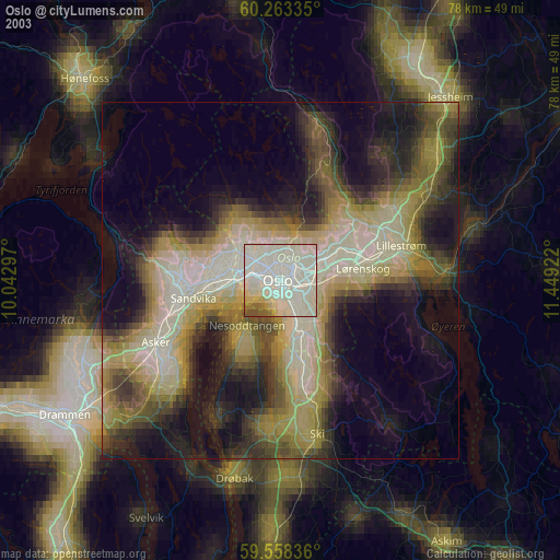
» NASA city lights 2003
» Earth at Night: Flat Maps 2012, 2016