Hønefoss night lights from space
Night Light of Hønefoss (Buskerud) from space (Norway) Src. Average luminocity for 10x10km area is 30.0992% and for 50x50km: 4.4931%.
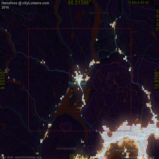
Analysis of Hønefoss night lights 2016
Square area 10x10 km:
 7.23%
7.23%90-99
7.64%80-89
2.89%70-79
2.17%60-69
0.72%50-59
1.86%40-49
1.55%30-39
1.86%20-29
10.23%10-19
35.12%0-9
28.72%Square area 50x50 km:
0.93%90-99
1.07%80-89
0.39%70-79
0.2%60-69
0.16%50-59
0.33%40-49
0.33%30-39
0.5%20-29
1.67%10-19
3.43%0-9
90.97%Clear (daylight) street map image can be seen on geolist.org.
Map coordinates:
60° 30' 57.5" North, 9° 33' 12.1" East
60° 10' 4.9" North, 10° 15' 23.3" East
59° 48' 59" North, 10° 57' 34.6" East
Some cities around Hønefoss sort by population:
• Oslo
39.3 km =24.4 mi,  136°
136°
• Drammen
47.2 km =29.3 mi,  183°
183°
• Asker
38.5 km =23.9 mi,  164°
164°
• Lillestrøm
49.9 km =31 mi,  118°
118°
• Jessheim
50.9 km =31.6 mi,  93°
93°
• Nesoddtangen
40.8 km =25.4 mi,  146°
146°
• Kløfta
49.9 km =31 mi,  102°
102°
• Tranby
40 km =24.9 mi, 179°
3151917 (p: 13,678)
Sources (retrieved 2019-11-25):
» Earth at Night: Flat Maps 2012, 2016