Asker night lights from space
Night Light of Asker (Akershus) from space (Norway) Src. Average luminocity for 10x10km area is 49.5279% and for 50x50km: 25.2954%.
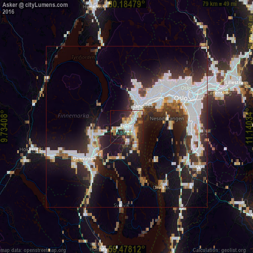
Analysis of Asker night lights 2016
Square area 10x10 km:
 11.47%
90-99
12.09%80-89
6.61%70-79
5.58%60-69
4.75%50-59
3.82%40-49
3.62%30-39
8.16%20-29
15.29%10-19
21.8%0-9
6.82%Square area 50x50 km:
7.63%90-99
6.02%80-89
1.59%70-79
1.53%60-69
1.73%50-59
1.93%40-49
1.92%30-39
4.21%20-29
7.24%10-19
14.67%0-9
51.53%Clear (daylight) street map image can be seen on geolist.org.
Map coordinates:
60° 11' 5.2" North, 9° 44' 2.7" East
59° 49' 60" North, 10° 26' 14" East
59° 28' 41.2" North, 11° 8' 25.2" East
Some cities around Asker sort by population:
• Oslo
19.4 km =12.1 mi,  62°
62°
• Drammen
16.4 km =10.2 mi,  232°
232°
• Ski
25.6 km =15.9 mi,  119°
119°
• Drøbak
21.8 km =13.5 mi,  150°
150°
• Nesoddtangen
13 km =8.1 mi,  75°
75°
• Ås
27.4 km =17 mi,  133°
133°
• Tranby
10.2 km =6.3 mi,  254°
254°
• Vestby
30.9 km =19.2 mi, 145°
3162657 (p: 60,926)
Sources (retrieved 2019-11-25):
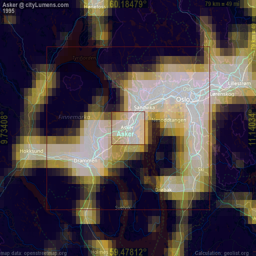
» NASA, Earths city lights 1995
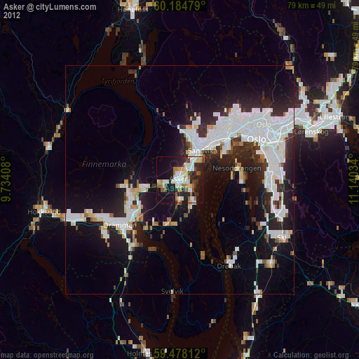
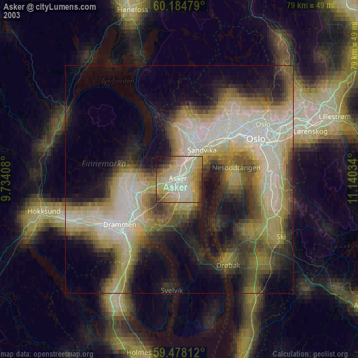
» NASA city lights 2003
» Earth at Night: Flat Maps 2012, 2016