Brumunddal night lights from space
Night Light of Brumunddal (Hedmark) from space (Norway) Src. Average luminocity for 10x10km area is 21.126% and for 50x50km: 6.2906%.
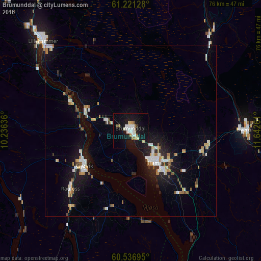
Analysis of Brumunddal night lights 2016
Square area 10x10 km:
 3.72%
3.72%90-99
5.37%80-89
2.79%70-79
1.45%60-69
1.55%50-59
1.65%40-49
0.1%30-39
0.31%20-29
0.31%10-19
34.92%0-9
47.83%Square area 50x50 km:
0.98%90-99
1.25%80-89
0.65%70-79
0.72%60-69
0.73%50-59
0.55%40-49
0.35%30-39
0.24%20-29
1.18%10-19
5.58%0-9
87.79%Clear (daylight) street map image can be seen on geolist.org.
Map coordinates:
61° 13' 16.6" North, 10° 14' 10.9" East
60° 52' 51.4" North, 10° 56' 22.1" East
60° 32' 13" North, 11° 38' 33.4" East
Some cities around Brumunddal sort by population:
• Hamar
11.9 km =7.4 mi,  144°
144°
• Lillehammer
36.5 km =22.7 mi,  315°
315°
• Gjøvik
16.4 km =10.2 mi,  234°
234°
• Hønefoss
87.6 km =54.4 mi,  205°
205°
• Elverum
33.7 km =20.9 mi,  89°
89°
• Jessheim
83.2 km =51.7 mi,  171°
171°
• Råholt
68.6 km =42.6 mi, 169°
• Raufoss
24.7 km =15.3 mi, 225°
3159894 (p: 8,441)
Sources (retrieved 2019-11-25):
» Earth at Night: Flat Maps 2012, 2016