Zeist night lights from space
Night Light of Zeist (Utrecht) from space (Netherlands) Src. Average luminocity for 10x10km area is 47.2037% and for 50x50km: 26.1171%.
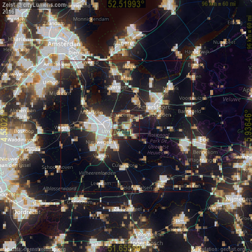
Analysis of Zeist night lights 2016
Square area 10x10 km:
 3.44%
3.44%90-99
6.22%80-89
8.07%70-79
6.48%60-69
7.41%50-59
8.07%40-49
11.77%30-39
12.17%20-29
23.81%10-19
11.77%0-9
0.79%Square area 50x50 km:
5.07%90-99
4.81%80-89
2.42%70-79
2.37%60-69
2.64%50-59
2.56%40-49
2.89%30-39
3.53%20-29
8.97%10-19
21.69%0-9
43.04%Clear (daylight) street map image can be seen on geolist.org.
Map coordinates:
52° 31' 11.7" North, 4° 31' 48.8" East
52° 5' 24" North, 5° 13' 60" East
51° 39' 21.2" North, 5° 56' 11.3" East
Some cities around Zeist sort by population:
• Utrecht
7.6 km =4.7 mi,  270°
270°
• Soest
10.1 km =6.3 mi,  23°
23°
• Driebergen-Rijsenburg
5.2 km =3.2 mi,  141°
141°
• Lunetten
7.4 km =4.6 mi,  245°
245°
• Doorn
9.9 km =6.2 mi,  129°
129°
• De Bilt
4.2 km =2.6 mi,  301°
301°
• Bunnik
3.5 km =2.2 mi,  222°
222°
• Odijk
4.2 km =2.6 mi,  177°
177°
2743977 (p: 60,949)
Sources (retrieved 2019-11-25):
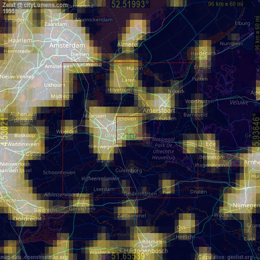
» NASA, Earths city lights 1995
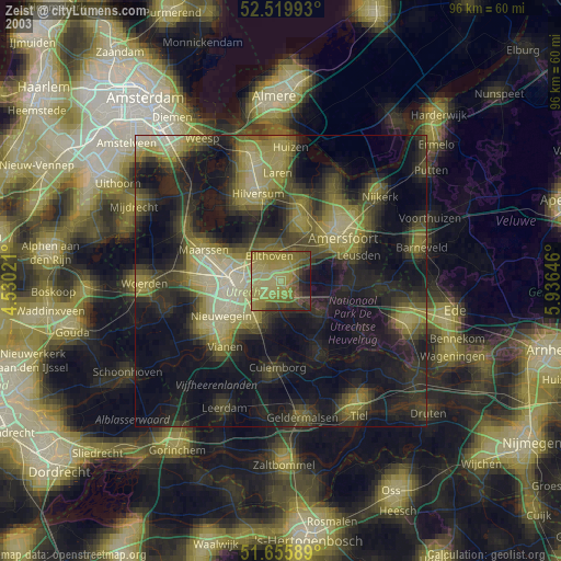
» NASA city lights 2003
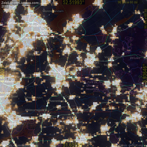
» Earth at Night: Flat Maps 2012, 2016