Doorn night lights from space
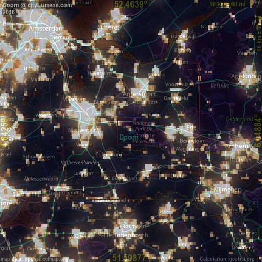
Night Light of Doorn (Utrecht) from space (Netherlands) Src. Average luminocity for 10x10km area is 7.7778% and for 50x50km: 25.542%.
Analysis of Doorn night lights 2016
Square area 10x10 km:
 0%
0%90-99
0.51%80-89
1.52%70-79
0.25%60-69
0.25%50-59
1.01%40-49
1.39%30-39
1.89%20-29
1.77%10-19
7.45%0-9
83.96%Square area 50x50 km:
4.92%90-99
4.78%80-89
2.48%70-79
2.23%60-69
2.42%50-59
2.39%40-49
2.66%30-39
3.09%20-29
8.45%10-19
22.77%0-9
43.81%Clear (daylight) street map image can be seen on geolist.org.
Map coordinates:
52° 27' 50" North, 4° 38' 33.3" East
52° 2' 0.3" North, 5° 20' 44.6" East
51° 35' 55.6" North, 6° 2' 55.8" East
Some cities around Doorn sort by population:
• Zeist
9.9 km =6.2 mi,  309°
309°
• Driebergen-Rijsenburg
5 km =3.1 mi,  296°
296°
• Wijk bij Duurstede
6.6 km =4.1 mi,  182°
182°
• Woudenberg
7.2 km =4.5 mi,  42°
42°
• Leersum
6.1 km =3.8 mi,  113°
113°
• Bunnik
10.7 km =6.6 mi,  290°
290°
• Odijk
7.8 km =4.8 mi, 285°
• Amerongen
8.5 km =5.3 mi, 113°
2756686 (p: 10,330)
Sources (retrieved 2019-11-25):
» Earth at Night: Flat Maps 2012, 2016