Zandvoort night lights from space
Night Light of Zandvoort (North Holland) from space (Netherlands) Src. Average luminocity for 10x10km area is 15.8914% and for 50x50km: 29.3436%.
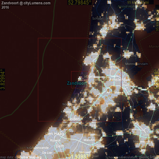
Analysis of Zandvoort night lights 2016
Square area 10x10 km:
 1.01%
1.01%90-99
1.52%80-89
0.51%70-79
0.76%60-69
1.52%50-59
4.04%40-49
2.9%30-39
3.54%20-29
12.88%10-19
16.16%0-9
55.18%Square area 50x50 km:
8.19%90-99
7.54%80-89
1.96%70-79
2.61%60-69
3.08%50-59
2.87%40-49
3.47%30-39
4.88%20-29
8.06%10-19
7.38%0-9
49.95%Clear (daylight) street map image can be seen on geolist.org.
Map coordinates:
52° 47' 54.4" North, 3° 49' 47.8" East
52° 22' 16.5" North, 4° 31' 59" East
51° 56' 23.5" North, 5° 14' 10.3" East
Some cities around Zandvoort sort by population:
• Haarlem
7.1 km =4.4 mi,  81°
81°
• Hoofddorp
13.1 km =8.1 mi,  125°
125°
• Velsen-Zuid
12.7 km =7.9 mi,  38°
38°
• Heemstede
6.6 km =4.1 mi,  111°
111°
• Lisse
12.5 km =7.8 mi,  172°
172°
• Hillegom
9.6 km =6 mi,  159°
159°
• Noordwijkerhout
12.5 km =7.8 mi,  192°
192°
• Bennebroek
7.2 km =4.5 mi,  141°
141°
2744042 (p: 16,868)
Sources (retrieved 2019-11-25):
» Earth at Night: Flat Maps 2012, 2016