Winterswijk night lights from space
Night Light of Winterswijk (Gelderland) from space (Netherlands) Src. Average luminocity for 10x10km area is 8.4293% and for 50x50km: 5.6325%.
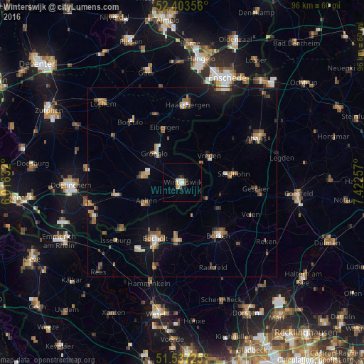
Analysis of Winterswijk night lights 2016
Square area 10x10 km:
 0.51%
0.51%90-99
3.03%80-89
0.88%70-79
0.63%60-69
0.76%50-59
1.01%40-49
0%30-39
0.51%20-29
1.52%10-19
0.63%0-9
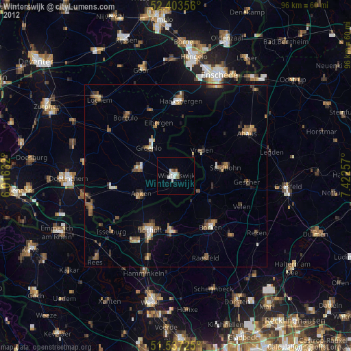
90.53%Square area 50x50 km:
0.33%90-99
0.73%80-89
0.42%70-79
0.65%60-69
0.98%50-59
1.21%40-49
0.82%30-39
0.64%20-29
0.77%10-19
2.87%0-9
90.58%Clear (daylight) street map image can be seen on geolist.org.
Map coordinates:
52° 24' 12.8" North, 6° 0' 58.8" East
51° 58' 21" North, 6° 43' 10" East
51° 32' 14.1" North, 7° 25' 21.3" East
Some cities around Winterswijk sort by population:
• Bocholt, DE
16.5 km =10.3 mi,  205°
205°
• Vreden, DE
10.4 km =6.5 mi,  45°
45°
• Stadtlohn, DE
13.9 km =8.6 mi,  80°
80°
• Lichtenvoorde
10.6 km =6.6 mi,  278°
278°
• Aalten
10.9 km =6.8 mi,  240°
240°
• Rhede, DE
15.3 km =9.5 mi,  186°
186°
• Eibergen
15 km =9.3 mi,  341°
341°
• Südlohn, DE
11 km =6.8 mi,  113°
113°
2744332 (p: 29,623)
Sources (retrieved 2019-11-25):
» Earth at Night: Flat Maps 2012, 2016