Twello night lights from space
Night Light of Twello (Gelderland) from space (Netherlands) Src. Average luminocity for 10x10km area is 22.2288% and for 50x50km: 7.6834%.
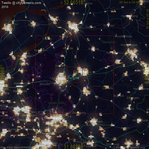
Analysis of Twello night lights 2016
Square area 10x10 km:
 3.04%
3.04%90-99
4.23%80-89
1.59%70-79
2.25%60-69
2.25%50-59
2.78%40-49
2.38%30-39
2.91%20-29
4.23%10-19
26.98%0-9
47.35%Square area 50x50 km:
0.77%90-99
1.05%80-89
0.73%70-79
0.89%60-69
1.08%50-59
1.27%40-49
0.93%30-39
0.75%20-29
1.78%10-19
6.92%0-9
83.83%Clear (daylight) street map image can be seen on geolist.org.
Map coordinates:
52° 39' 54.6" North, 5° 23' 58.8" East
52° 14' 12" North, 6° 6' 10" East
51° 48' 14.3" North, 6° 48' 21.3" East
Some cities around Twello sort by population:
• Apeldoorn
9.6 km =6 mi,  251°
251°
• Deventer
4.6 km =2.9 mi,  63°
63°
• Zutphen
12.8 km =8 mi,  148°
148°
• Vaassen
10.8 km =6.7 mi,  300°
300°
• Orden
12.1 km =7.5 mi, 251°
• Woudhuis
6.8 km =4.2 mi, 247°
• Matenveld
8.9 km =5.5 mi,  232°
232°
• Matendonk
7.6 km =4.7 mi,  235°
235°
2746060 (p: 13,500)
Sources (retrieved 2019-11-25):
» Earth at Night: Flat Maps 2012, 2016