Statenkwartier night lights from space
Night Light of Statenkwartier (South Holland) from space (Netherlands) Src. Average luminocity for 10x10km area is 62.0582% and for 50x50km: 44.4142%.
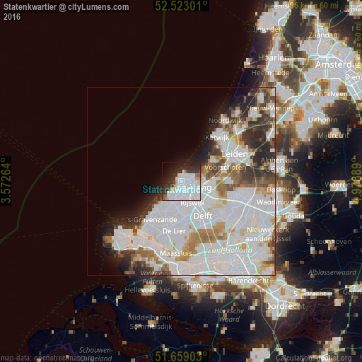
Analysis of Statenkwartier night lights 2016
Square area 10x10 km:
 34.52%
90-99
12.04%80-89
2.78%70-79
1.32%60-69
1.98%50-59
2.91%40-49
1.46%30-39
8.99%20-29
17.33%10-19
9.79%0-9
6.88%Square area 50x50 km:
20.11%90-99
11.55%80-89
2.3%70-79
3.04%60-69
3.92%50-59
2.75%40-49
2.73%30-39
3.85%20-29
5.52%10-19
4.35%0-9
39.87%Clear (daylight) street map image can be seen on geolist.org.
Map coordinates:
52° 31' 22.8" North, 3° 34' 21.5" East
52° 5' 35.2" North, 4° 16' 32.8" East
51° 39' 32.5" North, 4° 58' 44" East
Some cities around Statenkwartier sort by population:
• The Hague
2.4 km =1.5 mi,  139°
139°
• Rijswijk
7.2 km =4.5 mi,  151°
151°
• Voorburg
6.1 km =3.8 mi,  110°
110°
• Ypenburg
8.7 km =5.4 mi,  132°
132°
• Scheveningen
1.3 km =0.8 mi,  359°
359°
• Duindorp
1.1 km =0.7 mi,  256°
256°
• Poeldijk
8.6 km =5.3 mi,  206°
206°
• Vogelwijk
2.7 km =1.7 mi,  225°
225°
2746826 (p: 9,300)
Sources (retrieved 2019-11-25):
» Earth at Night: Flat Maps 2012, 2016