Hoek van Holland night lights from space
Night Light of Hoek van Holland (South Holland) from space (Netherlands) Src. Average luminocity for 10x10km area is 81.4811% and for 50x50km: 33.8928%.
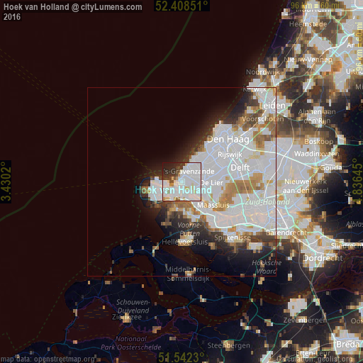
Analysis of Hoek van Holland night lights 2016
Square area 10x10 km:
 39.77%
90-99
27.9%80-89
5.81%70-79
2.02%60-69
2.02%50-59
1.26%40-49
2.9%30-39
6.31%20-29
7.58%10-19
4.42%0-9
0%Square area 50x50 km:
15.35%90-99
8.3%80-89
1.69%70-79
2.27%60-69
3.34%50-59
2.21%40-49
1.59%30-39
2.69%20-29
4.31%10-19
5.63%0-9
52.6%Clear (daylight) street map image can be seen on geolist.org.
Map coordinates:
52° 24' 30.6" North, 3° 25' 48.7" East
51° 58' 39" North, 4° 7' 60" East
51° 32' 32.3" North, 4° 50' 11.2" East
Some cities around Hoek van Holland sort by population:
• Maassluis
10 km =6.2 mi,  126°
126°
• 's-Gravenzande
3.5 km =2.2 mi,  39°
39°
• Naaldwijk
5.5 km =3.4 mi,  70°
70°
• Rozenburg
11.4 km =7.1 mi,  135°
135°
• De Lier
7.9 km =4.9 mi,  92°
92°
• Monster
6.1 km =3.8 mi,  27°
27°
• Honselersdijk
7 km =4.3 mi,  62°
62°
• Poeldijk
7.9 km =4.9 mi,  48°
48°
2754007 (p: 9,400)
Sources (retrieved 2019-11-25):
» Earth at Night: Flat Maps 2012, 2016