Schiedam night lights from space
Night Light of Schiedam (South Holland) from space (Netherlands) Src. Average luminocity for 10x10km area is 93.1894% and for 50x50km: 51.413%.
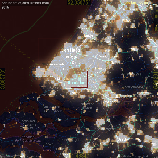
Analysis of Schiedam night lights 2016
Square area 10x10 km:
 51.89%
90-99
29.29%80-89
1.52%70-79
2.53%60-69
12.37%50-59
2.4%40-49
0%30-39
0%20-29
0%10-19
0%0-9
0%Square area 50x50 km:
21.41%90-99
13.11%80-89
3.29%70-79
3.52%60-69
4.7%50-59
3.46%40-49
3.37%30-39
5%20-29
7.37%10-19
9.12%0-9
25.65%Clear (daylight) street map image can be seen on geolist.org.
Map coordinates:
52° 21' 2.7" North, 3° 41' 8.7" East
51° 55' 9" North, 4° 23' 20" East
51° 29' 0.2" North, 5° 5' 31.2" East
Some cities around Schiedam sort by population:
• Rotterdam
6.2 km =3.9 mi,  86°
86°
• Vlaardingen
3.3 km =2.1 mi,  257°
257°
• Rhoon
7.2 km =4.5 mi,  161°
161°
• Pendrecht
7.6 km =4.7 mi,  133°
133°
• Carnisse
6.9 km =4.3 mi,  118°
118°
• Spangen
3.2 km =2 mi, 94°
• Delfshaven
4.7 km =2.9 mi,  109°
109°
• Overschie
3.4 km =2.1 mi,  50°
50°
2747596 (p: 75,438)
Sources (retrieved 2019-11-25):
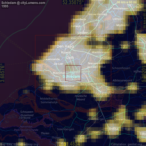
» NASA, Earths city lights 1995
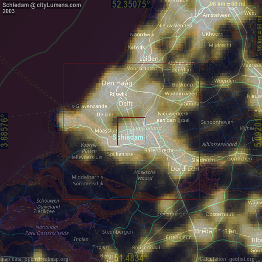
» NASA city lights 2003
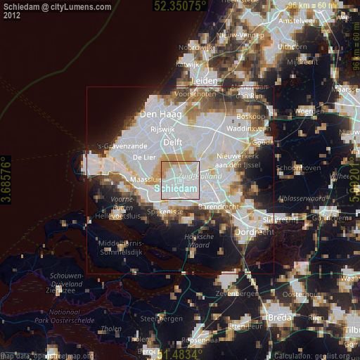
» Earth at Night: Flat Maps 2012, 2016