Rotterdam night lights from space
Night Light of Rotterdam (South Holland) from space (Netherlands) Src. Average luminocity for 10x10km area is 97.1932% and for 50x50km: 50.5077%.
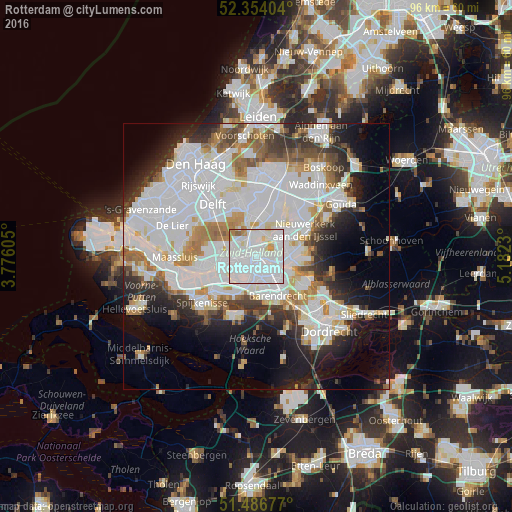
Analysis of Rotterdam night lights 2016
Square area 10x10 km:
 61.74%
90-99
29.17%80-89
3.54%70-79
2.27%60-69
2.27%50-59
1.01%40-49
0%30-39
0%20-29
0%10-19
0%0-9
0%Square area 50x50 km:
20.99%90-99
12.7%80-89
3.28%70-79
3.48%60-69
4.69%50-59
3.37%40-49
3.12%30-39
4.61%20-29
6.9%10-19
9.99%0-9
26.87%Clear (daylight) street map image can be seen on geolist.org.
Map coordinates:
52° 21' 14.5" North, 3° 46' 33.8" East
51° 55' 21" North, 4° 28' 45" East
51° 29' 12.4" North, 5° 10' 56.3" East
Some cities around Rotterdam sort by population:
• Schiebroek
4 km =2.5 mi,  352°
352°
• Bloemhof
3.1 km =1.9 mi,  153°
153°
• Carnisse
3.7 km =2.3 mi,  181°
181°
• Spangen
3.1 km =1.9 mi,  258°
258°
• 's-Gravenland
5.1 km =3.2 mi,  88°
88°
• Feijenoord
2.2 km =1.4 mi,  122°
122°
• Delfshaven
2.7 km =1.7 mi,  222°
222°
• Overschie
4 km =2.5 mi,  296°
296°
2747891 (p: 598,199)
Sources (retrieved 2019-11-25):
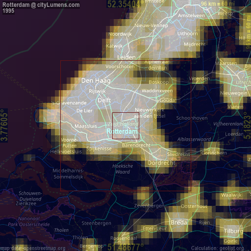
» NASA, Earths city lights 1995
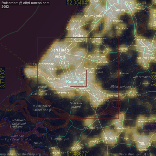
» NASA city lights 2003
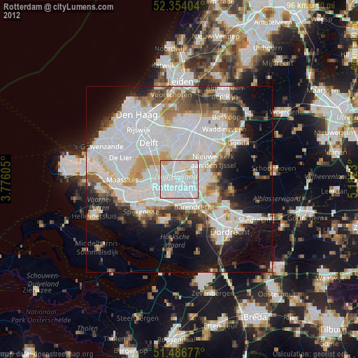
» Earth at Night: Flat Maps 2012, 2016