Feijenoord night lights from space
Night Light of Feijenoord (South Holland) from space (Netherlands) Src. Average luminocity for 10x10km area is 98.1768% and for 50x50km: 49.6885%.
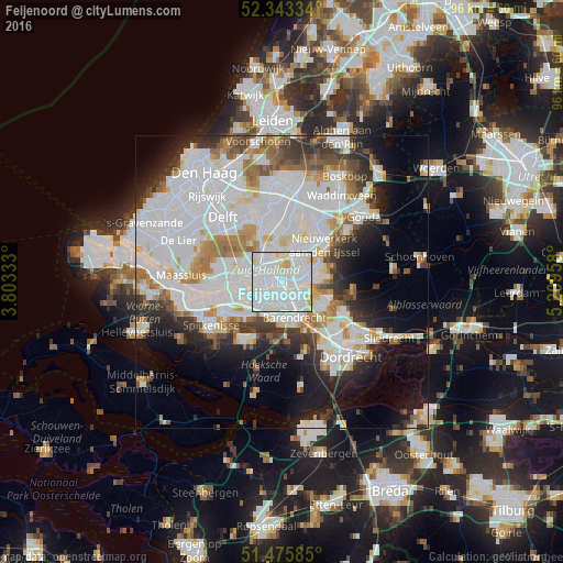
Analysis of Feijenoord night lights 2016
Square area 10x10 km:
 60.98%
90-99
32.32%80-89
5.05%70-79
1.64%60-69
0%50-59
0%40-49
0%30-39
0%20-29
0%10-19
0%0-9
0%Square area 50x50 km:
20.59%90-99
12.52%80-89
3.38%70-79
3.49%60-69
4.54%50-59
3.24%40-49
2.96%30-39
4.58%20-29
6.22%10-19
9.96%0-9
28.52%Clear (daylight) street map image can be seen on geolist.org.
Map coordinates:
52° 20' 36" North, 3° 48' 12" East
51° 54' 42.1" North, 4° 30' 23.2" East
51° 28' 33.1" North, 5° 12' 34.5" East
Some cities around Feijenoord sort by population:
• Rotterdam
2.2 km =1.4 mi,  302°
302°
• Lombardijen
4.3 km =2.7 mi,  165°
165°
• Vreewijk
3.2 km =2 mi,  163°
163°
• Bloemhof
1.7 km =1.1 mi,  196°
196°
• Zuidwijk
4.3 km =2.7 mi, 199°
• Carnisse
3.2 km =2 mi,  218°
218°
• 's-Gravenland
3.5 km =2.2 mi,  67°
67°
• Delfshaven
3.7 km =2.3 mi,  258°
258°
2755925 (p: 7,275)
Sources (retrieved 2019-11-25):
» Earth at Night: Flat Maps 2012, 2016