Bloemhof night lights from space
Night Light of Bloemhof (South Holland) from space (Netherlands) Src. Average luminocity for 10x10km area is 97.6023% and for 50x50km: 49.407%.
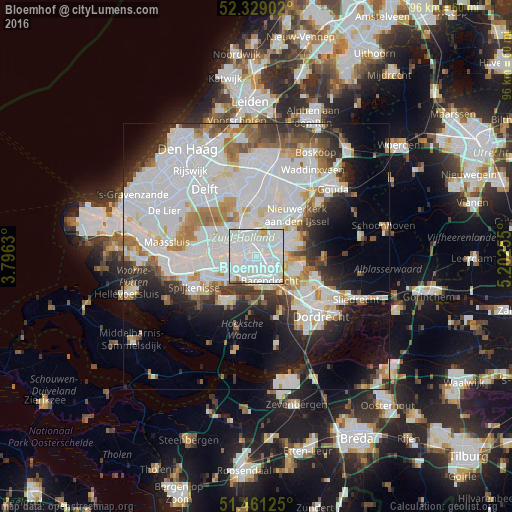
Analysis of Bloemhof night lights 2016
Square area 10x10 km:
 61.36%
90-99
31.94%80-89
3.16%70-79
1.39%60-69
0.88%50-59
0.51%40-49
0.76%30-39
0%20-29
0%10-19
0%0-9
0%Square area 50x50 km:
20.75%90-99
12.48%80-89
3.32%70-79
3.45%60-69
4.51%50-59
3.06%40-49
2.73%30-39
4.52%20-29
5.96%10-19
9.77%0-9
29.45%Clear (daylight) street map image can be seen on geolist.org.
Map coordinates:
52° 19' 44.5" North, 3° 47' 46.7" East
51° 53' 50" North, 4° 29' 57.9" East
51° 27' 40.5" North, 5° 12' 9.2" East
Some cities around Bloemhof sort by population:
• Rotterdam
3.1 km =1.9 mi,  333°
333°
• Lombardijen
3 km =1.9 mi,  149°
149°
• Vreewijk
2 km =1.2 mi,  136°
136°
• Zuidwijk
2.6 km =1.6 mi,  201°
201°
• Pendrecht
3.5 km =2.2 mi,  216°
216°
• Carnisse
1.7 km =1.1 mi,  239°
239°
• Feijenoord
1.7 km =1.1 mi,  16°
16°
• Delfshaven
3.3 km =2.1 mi,  284°
284°
2758795 (p: 13,715)
Sources (retrieved 2019-11-25):
» Earth at Night: Flat Maps 2012, 2016