Reusel night lights from space
Night Light of Reusel (North Brabant) from space (Netherlands) Src. Average luminocity for 10x10km area is 10.0742% and for 50x50km: 22.3961%.
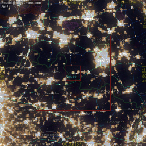
Analysis of Reusel night lights 2016
Square area 10x10 km:
 0.28%
0.28%90-99
0.42%80-89
1.4%70-79
2.24%60-69
1.26%50-59
2.52%40-49
1.68%30-39
0.28%20-29
2.66%10-19
1.12%0-9
86.13%Square area 50x50 km:
3.79%90-99
4.06%80-89
2.02%70-79
2.18%60-69
2.09%50-59
3.09%40-49
3.01%30-39
2.83%20-29
6.13%10-19
19.68%0-9
51.12%Clear (daylight) street map image can be seen on geolist.org.
Map coordinates:
51° 47' 57.9" North, 4° 27' 43.8" East
51° 21' 45" North, 5° 9' 55" East
50° 55' 16.9" North, 5° 52' 6.3" East
Some cities around Reusel sort by population:
• Eersel
10.6 km =6.6 mi,  93°
93°
• Bergeijk
14.2 km =8.8 mi,  109°
109°
• Ravels, BE
12.1 km =7.5 mi,  275°
275°
• Oud-Turnhout, BE
13.5 km =8.4 mi,  249°
249°
• Arendonk, BE
7.2 km =4.5 mi,  232°
232°
• Retie, BE
12.1 km =7.5 mi,  208°
208°
• Bladel
3.9 km =2.4 mi,  80°
80°
• Hilvarenbeek
13.8 km =8.6 mi,  352°
352°
2748217 (p: 7,055)
Sources (retrieved 2019-11-25):
» Earth at Night: Flat Maps 2012, 2016