Bladel night lights from space
Night Light of Bladel (North Brabant) from space (Netherlands) Src. Average luminocity for 10x10km area is 11.3585% and for 50x50km: 22.3898%.
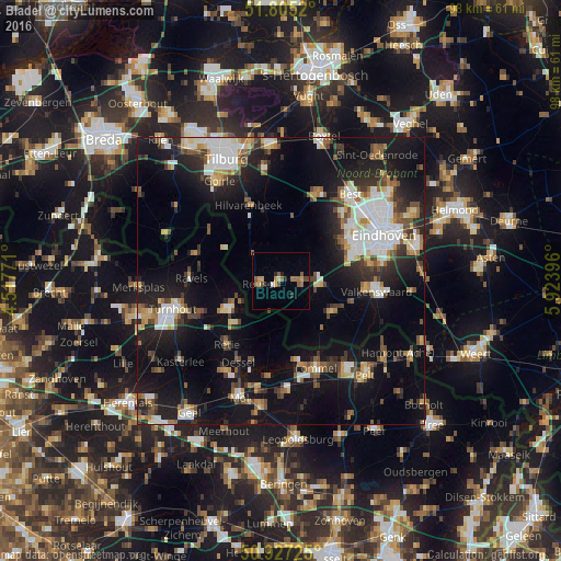
Analysis of Bladel night lights 2016
Square area 10x10 km:
 0.28%
0.28%90-99
0.28%80-89
0.98%70-79
2.8%60-69
2.52%50-59
3.36%40-49
1.96%30-39
0.56%20-29
2.1%10-19
0.28%0-9
84.87%Square area 50x50 km:
3.64%90-99
4.05%80-89
2.17%70-79
2.12%60-69
2.2%50-59
3.08%40-49
2.92%30-39
2.83%20-29
6.1%10-19
19.19%0-9
51.7%Clear (daylight) street map image can be seen on geolist.org.
Map coordinates:
51° 48' 18.7" North, 4° 31' 3.8" East
51° 22' 6" North, 5° 13' 15" East
50° 55' 38.1" North, 5° 55' 26.3" East
Some cities around Bladel sort by population:
• Eersel
6.9 km =4.3 mi,  100°
100°
• Bergeijk
11 km =6.8 mi,  119°
119°
• Arendonk, BE
10.8 km =6.7 mi,  242°
242°
• Retie, BE
14.9 km =9.3 mi,  220°
220°
• Hilvarenbeek
14.3 km =8.9 mi,  336°
336°
• Reusel
3.9 km =2.4 mi,  260°
260°
• Veldhoven
13.8 km =8.6 mi,  66°
66°
• Zeelst
14.9 km =9.3 mi, 65°
2758878 (p: 9,785)
Sources (retrieved 2019-11-25):
» Earth at Night: Flat Maps 2012, 2016