Joure night lights from space
Night Light of Joure (Friesland) from space (Netherlands) Src. Average luminocity for 10x10km area is 4.6005% and for 50x50km: 4.5045%.
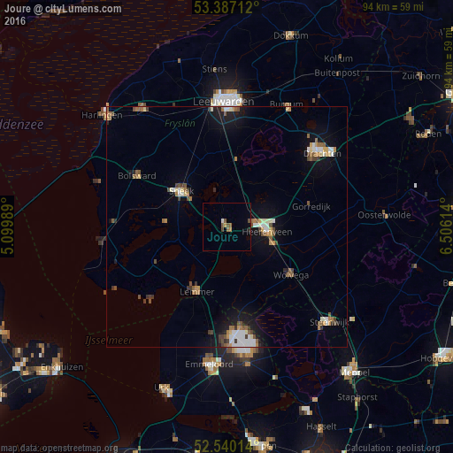
Analysis of Joure night lights 2016
Square area 10x10 km:
 0.4%
0.4%90-99
0.13%80-89
0%70-79
0.93%60-69
0.66%50-59
1.59%40-49
1.46%30-39
0.13%20-29
0.53%10-19
0%0-9
94.18%Square area 50x50 km:
0.51%90-99
0.78%80-89
0.27%70-79
0.52%60-69
0.59%50-59
0.76%40-49
0.72%30-39
0.51%20-29
0.51%10-19
3.13%0-9
91.69%Clear (daylight) street map image can be seen on geolist.org.
Map coordinates:
53° 23' 13.6" North, 5° 5' 59.6" East
52° 57' 56.5" North, 5° 48' 10.8" East
52° 32' 24.5" North, 6° 30' 22.1" East
Some cities around Joure sort by population:
• Heerenveen
7.8 km =4.8 mi,  95°
95°
• Sneek
12.2 km =7.6 mi,  307°
307°
• Wolvega
16.4 km =10.2 mi,  127°
127°
• Lemmer
14.7 km =9.1 mi,  205°
205°
• Bolsward
21.3 km =13.2 mi,  301°
301°
• De Greiden
7.6 km =4.7 mi, 103°
• Gorredijk
18.1 km =11.2 mi,  75°
75°
• Grou
14.5 km =9 mi,  9°
9°
2753197 (p: 12,902)
Sources (retrieved 2019-11-25):
» Earth at Night: Flat Maps 2012, 2016