De Greiden night lights from space
Night Light of De Greiden (Friesland) from space (Netherlands) Src. Average luminocity for 10x10km area is 17.2659% and for 50x50km: 4.4711%.
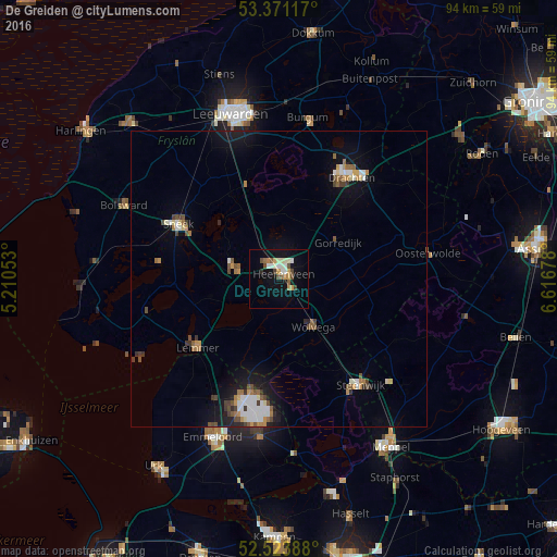
Analysis of De Greiden night lights 2016
Square area 10x10 km:
 2.25%
2.25%90-99
3.97%80-89
1.46%70-79
2.51%60-69
1.19%50-59
2.12%40-49
3.44%30-39
0.53%20-29
0.53%10-19
13.1%0-9
68.92%Square area 50x50 km:
0.61%90-99
0.8%80-89
0.29%70-79
0.51%60-69
0.55%50-59
0.59%40-49
0.74%30-39
0.46%20-29
0.43%10-19
3.1%0-9
91.93%Clear (daylight) street map image can be seen on geolist.org.
Map coordinates:
53° 22' 16.2" North, 5° 12' 37.9" East
52° 56' 58.6" North, 5° 54' 49.2" East
52° 31' 26" North, 6° 37' 0.4" East
Some cities around De Greiden sort by population:
• Heerenveen
1.1 km =0.7 mi,  16°
16°
• Sneek
19.4 km =12.1 mi,  298°
298°
• Joure
7.6 km =4.7 mi,  283°
283°
• Wolvega
10 km =6.2 mi,  145°
145°
• Lemmer
17.9 km =11.1 mi,  230°
230°
• Gorredijk
11.9 km =7.4 mi,  57°
57°
• De Drait
19.4 km =12.1 mi,  32°
32°
• Grou
16.9 km =10.5 mi,  342°
342°
2757619 (p: 7,470)
Sources (retrieved 2019-11-25):
» Earth at Night: Flat Maps 2012, 2016