Hoogland night lights from space
Night Light of Hoogland (Utrecht) from space (Netherlands) Src. Average luminocity for 10x10km area is 55.0331% and for 50x50km: 27.3444%.
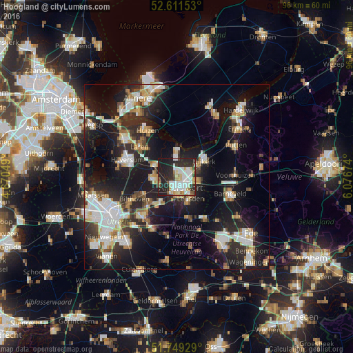
Analysis of Hoogland night lights 2016
Square area 10x10 km:
 15.08%
90-99
15.74%80-89
5.56%70-79
4.23%60-69
3.7%50-59
3.17%40-49
3.17%30-39
6.61%20-29
28.31%10-19
14.42%0-9
0%Square area 50x50 km:
5.27%90-99
5.48%80-89
2.52%70-79
2.88%60-69
2.95%50-59
2.25%40-49
2.8%30-39
3.42%20-29
10.25%10-19
21.81%0-9
40.38%Clear (daylight) street map image can be seen on geolist.org.
Map coordinates:
52° 36' 41.5" North, 4° 40' 13.8" East
52° 10' 57" North, 5° 22' 25" East
51° 44' 57.4" North, 6° 4' 36.3" East
Some cities around Hoogland sort by population:
• Amersfoort
3.2 km =2 mi,  162°
162°
• Soest
5.7 km =3.5 mi,  259°
259°
• Nijkerk
8.7 km =5.4 mi,  61°
61°
• Leusden
6.8 km =4.2 mi,  144°
144°
• Baarn
6.7 km =4.2 mi,  298°
298°
• Woudenberg
11.7 km =7.3 mi,  165°
165°
• Randenbroek
4.2 km =2.6 mi,  153°
153°
• Doornsteeg
7.6 km =4.7 mi,  46°
46°
2753686 (p: 10,587)
Sources (retrieved 2019-11-25):
» Earth at Night: Flat Maps 2012, 2016