Wijk bij Duurstede night lights from space
Night Light of Wijk bij Duurstede (Utrecht) from space (Netherlands) Src. Average luminocity for 10x10km area is 5.4394% and for 50x50km: 25.3052%.
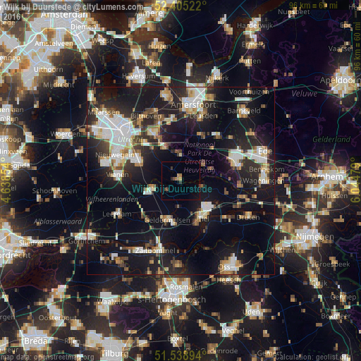
Analysis of Wijk bij Duurstede night lights 2016
Square area 10x10 km:
 0%
0%90-99
0%80-89
0.25%70-79
1.01%60-69
1.39%50-59
0.13%40-49
1.52%30-39
1.01%20-29
0.51%10-19
1.77%0-9
92.42%Square area 50x50 km:
4.8%90-99
4.48%80-89
2.44%70-79
2.21%60-69
2.57%50-59
2.63%40-49
2.76%30-39
3.1%20-29
7.95%10-19
23.55%0-9
43.51%Clear (daylight) street map image can be seen on geolist.org.
Map coordinates:
52° 24' 18.8" North, 4° 38' 18.7" East
51° 58' 27" North, 5° 20' 30" East
51° 32' 20.2" North, 6° 2' 41.2" East
Some cities around Wijk bij Duurstede sort by population:
• Tiel
11.4 km =7.1 mi,  148°
148°
• Culemborg
8.1 km =5 mi,  254°
254°
• Geldermalsen
11 km =6.8 mi,  199°
199°
• Driebergen-Rijsenburg
9.7 km =6 mi,  334°
334°
• Doorn
6.6 km =4.1 mi,  2°
2°
• Leersum
7.2 km =4.5 mi,  54°
54°
• Odijk
11.3 km =7 mi,  320°
320°
• Amerongen
8.7 km =5.4 mi,  68°
68°
2744483 (p: 17,465)
Sources (retrieved 2019-11-25):
» Earth at Night: Flat Maps 2012, 2016