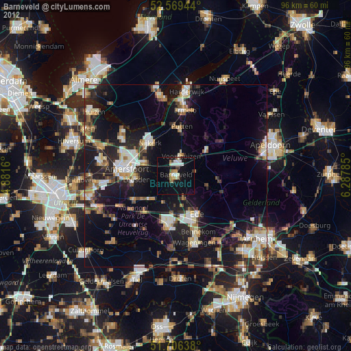
Barneveld night lights from space
Night Light of Barneveld (Gelderland) from space (Netherlands) Src. Average luminocity for 10x10km area is 20.6429% and for 50x50km: 18.8958%.
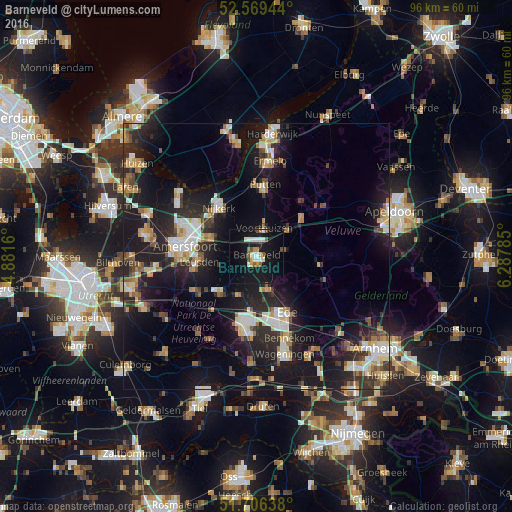
Analysis of Barneveld night lights 2016
Square area 10x10 km:
 3.57%
3.57%90-99
3.84%80-89
0.79%70-79
3.17%60-69
0.26%50-59
3.44%40-49
1.85%30-39
0%20-29
1.06%10-19
34.79%0-9
47.22%Square area 50x50 km:
2.36%90-99
3.13%80-89
2.11%70-79
2.21%60-69
2.33%50-59
1.93%40-49
2.12%30-39
2.25%20-29
7.06%10-19
19.2%0-9
55.3%Clear (daylight) street map image can be seen on geolist.org.
Map coordinates:
52° 34' 10" North, 4° 52' 53.8" East
52° 8' 24" North, 5° 35' 5" East
51° 42' 23" North, 6° 17' 16.3" East
Some cities around Barneveld sort by population:
• Ede
12.9 km =8 mi,  157°
157°
• Veenendaal
12.5 km =7.8 mi,  188°
188°
• Nijkerk
11.2 km =7 mi,  322°
322°
• Leusden
10.5 km =6.5 mi,  265°
265°
• Lunteren
6.6 km =4.1 mi, 157°
• Voorthuizen
5.4 km =3.4 mi,  15°
15°
• Scherpenzeel
9.3 km =5.8 mi,  224°
224°
• Randenbroek
12.6 km =7.8 mi, 274°
2759407 (p: 28,640)
Sources (retrieved 2019-11-25):
» Earth at Night: Flat Maps 2012, 2016