Santa Teresa night lights from space
Night Light of Santa Teresa (Carazo) from space (Nicaragua) Src. Average luminocity for 10x10km area is 0.5289% and for 50x50km: 3.9725%.
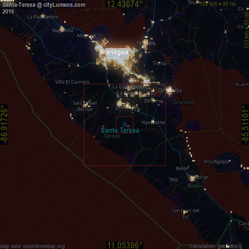
Analysis of Santa Teresa night lights 2016
Square area 10x10 km:
 0%
0%90-99
0%80-89
0%70-79
0%60-69
0%50-59
0%40-49
0.83%30-39
0%20-29
0%10-19
0%0-9
99.17%Square area 50x50 km:
0.04%90-99
0.29%80-89
0.66%70-79
0.46%60-69
0.57%50-59
0.51%40-49
0.63%30-39
0.89%20-29
0.99%10-19
4.78%0-9
90.16%Clear (daylight) street map image can be seen on geolist.org.
Map coordinates:
12° 25' 50.7" North, 86° 55' 2.1" West
11° 44' 35.6" North, 86° 12' 50.9" West
11° 3' 14.3" North, 85° 30' 39.6" West
Some cities around Santa Teresa sort by population:
• Diriamba
13.1 km =8.1 mi,  347°
347°
• Jinotepe
11.9 km =7.4 mi,  7°
7°
• San Marcos
18.5 km =11.5 mi,  3°
3°
• Masatepe
20.5 km =12.7 mi,  21°
21°
• Nandaime
17.6 km =10.9 mi,  85°
85°
• Niquinohomo
22.2 km =13.8 mi,  35°
35°
• Dolores
12.6 km =7.8 mi,  359°
359°
• La Concepción
21.7 km =13.5 mi, 7°
3616381 (p: 5,789)
Sources (retrieved 2019-11-25):
» Earth at Night: Flat Maps 2012, 2016