Wurno night lights from space
Night Light of Wurno (Sokoto) from space (Nigeria) Src. Average luminocity for 10x10km area is 0.0062% and for 50x50km: 0.541%.
Analysis of Wurno night lights 2016
Square area 10x10 km:
100  0%
0%
90-99 0%
80-89 0%
70-79 0%
60-69 0%
50-59 0%
40-49 0%
30-39 0%
20-29 0%
10-19 0%
0-9 100%
0%90-99
0%80-89
0%70-79
0%60-69
0%50-59
0%40-49
0%30-39
0%20-29
0%10-19
0%0-9
100%Square area 50x50 km:
100 0.01%
90-99 0.04%
80-89 0.04%
70-79 0.07%
60-69 0.07%
50-59 0.16%
40-49 0.11%
30-39 0.02%
20-29 0.11%
10-19 0.83%
0-9 98.54%
0.01%90-99
0.04%80-89
0.04%70-79
0.07%60-69
0.07%50-59
0.16%40-49
0.11%30-39
0.02%20-29
0.11%10-19
0.83%0-9
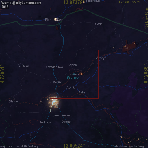
98.54%Clear (daylight) street map image can be seen on geolist.org.
Map coordinates:
13° 58' 25.6" North, 4° 43' 14.2" East
13° 17' 25.7" North, 5° 25' 25.4" East
12° 36' 18.9" North, 6° 7' 36.7" East
Some cities around Wurno sort by population:
• Sokoto
32 km =19.9 mi,  217°
217°
• Gwadabawa
21.4 km =13.3 mi,  290°
290°
• Illela
50.8 km =31.6 mi,  344°
344°
• Gandi
50.2 km =31.2 mi,  136°
136°
• Dange
49.4 km =30.7 mi,  189°
189°
• Goronyo
31.8 km =19.8 mi,  57°
57°
• Rabah
20.8 km =12.9 mi,  154°
154°
• Binji
56.2 km =34.9 mi,  262°
262°
2318858 (p: 13,087)
Sources (retrieved 2019-11-25):
» Earth at Night: Flat Maps 2012, 2016