Gwarzo night lights from space
Night Light of Gwarzo (Kano) from space (Nigeria) Src. Average luminocity for 10x10km area is 0% and for 50x50km: 0.2338%.
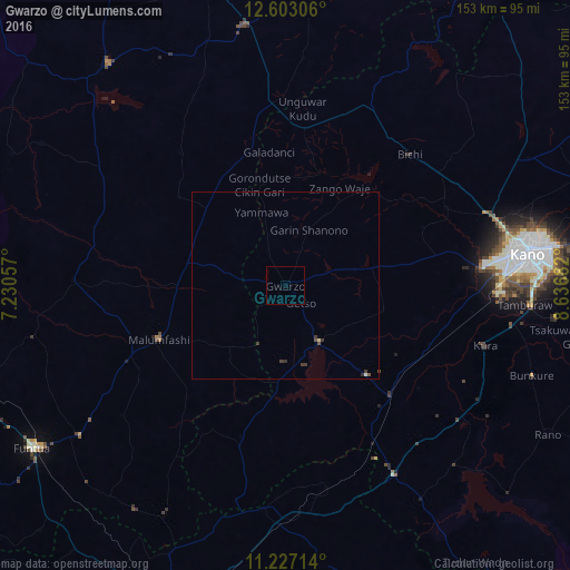
Analysis of Gwarzo night lights 2016
Square area 10x10 km:
 0%
0%90-99
0%80-89
0%70-79
0%60-69
0%50-59
0%40-49
0%30-39
0%20-29
0%10-19
0%0-9
100%Square area 50x50 km:
0%90-99
0.03%80-89
0.03%70-79
0%60-69
0%50-59
0.03%40-49
0.11%30-39
0.22%20-29
0.05%10-19
0%0-9
99.53%Clear (daylight) street map image can be seen on geolist.org.
Map coordinates:
12° 36' 11" North, 7° 13' 50.1" East
11° 54' 57.5" North, 7° 56' 1.3" East
11° 13' 37.7" North, 8° 38' 12.6" East
Some cities around Gwarzo sort by population:
• Malumfashi
36.9 km =22.9 mi,  247°
247°
• Bebeji
45.2 km =28.1 mi,  127°
127°
• Kankara
56.9 km =35.4 mi,  271°
271°
• Kura
55.9 km =34.7 mi,  106°
106°
• Musawa
37.2 km =23.1 mi,  309°
309°
• Dan Gora
48.6 km =30.2 mi,  150°
150°
• Jikamshi
33.5 km =20.8 mi,  328°
328°
• Gora
29.2 km =18.1 mi, 269°
2339756 (p: 16,303)
Sources (retrieved 2019-11-25):
» Earth at Night: Flat Maps 2012, 2016